print, engraving
#
baroque
#
dutch-golden-age
# print
#
old engraving style
#
line
#
cityscape
#
engraving
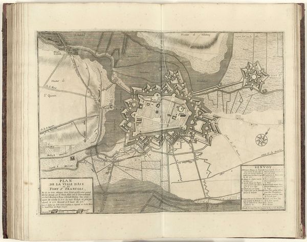
Dimensions: height 505 mm, width 392 mm
Copyright: Rijks Museum: Open Domain
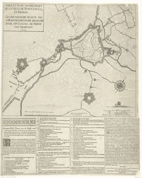
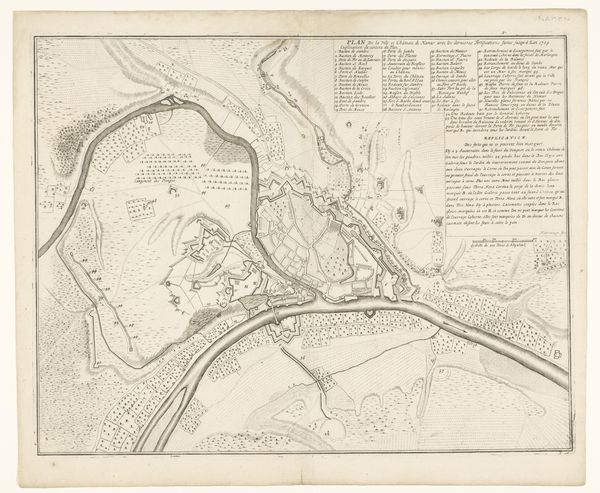
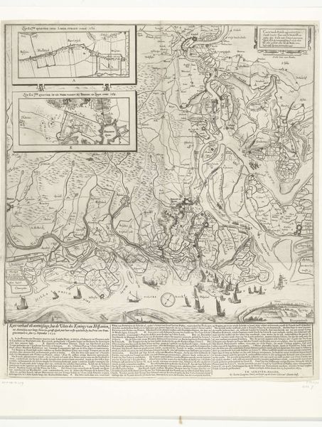
Editor: This print, titled "Kaart met de Nederlandse forten aan de Schelde, 1747," seems to be an old map made in 1747. The style, with fine lines and a focus on detail, gives it a very formal and precise feeling. The print captures a moment frozen in time. How does this work speak to the socio-political environment of the time it was created? Curator: This map serves as both a navigational tool and a symbol of power, reflecting the strategic importance of the Scheldt River and its fortifications. Consider its public role – such maps would have informed military strategy, but also projected an image of Dutch control and competence. It is crucial to analyze how institutions shaped such a piece; in this case, likely commissioned by or created for the military or government. Editor: So, beyond just showing the lay of the land, it was actively reinforcing a particular political narrative? Curator: Precisely. Look at how the forts are emphasized, seemingly exaggerated in scale and detail. How might this influence the viewer's understanding of Dutch military strength? And who would be the primary audience for such imagery? Consider both domestic consumption and its potential role in international relations and projecting power abroad. Editor: I see. It's not just about the accuracy of the depiction, but about the message it sends about Dutch authority and influence. A political advertisement disguised as cartography! Thanks, that really reframes how I look at this piece. Curator: Indeed, reflecting on art as a manifestation of political agenda encourages deeper engagement with imagery, both historical and contemporary.
Comments
No comments
Be the first to comment and join the conversation on the ultimate creative platform.
More like this