drawing, painting, watercolor
#
drawing
#
water colours
#
baroque
#
painting
#
watercolor
#
coloured pencil
#
cityscape
#
genre-painting
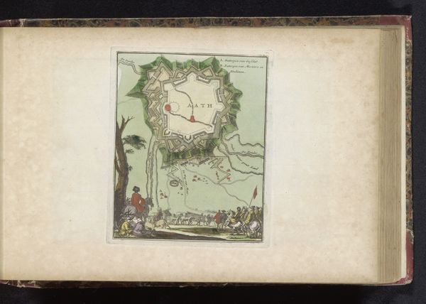
Dimensions: height 148 mm, width 222 mm
Copyright: Rijks Museum: Open Domain
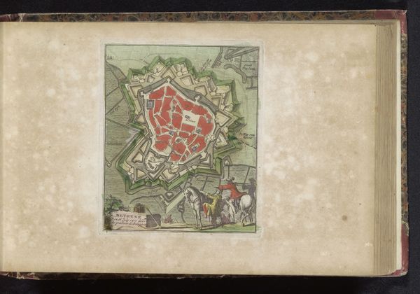
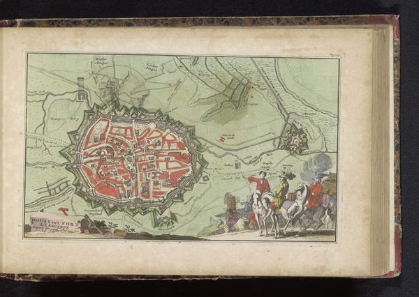
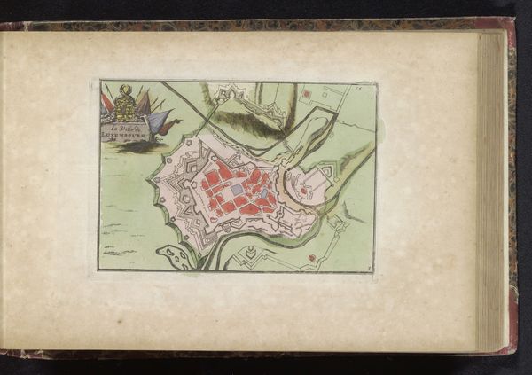
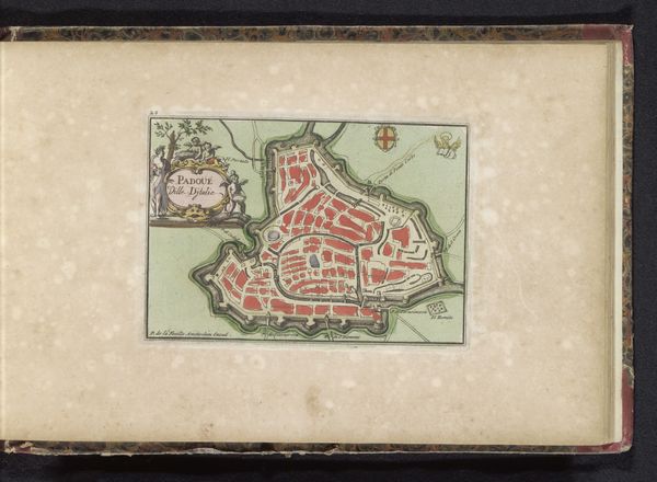
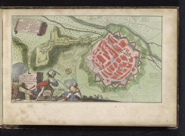
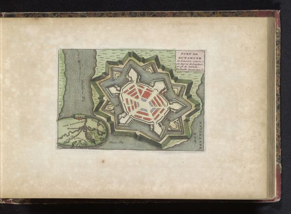
Curator: Here we have a watercolor and ink map entitled "Plattegrond van Le Quesnoy," dating back to 1735. It presents a plan of the fortified town. Editor: Immediately, I'm struck by how it seems to blend the practical and the symbolic. It’s a city plan but rendered almost like a jewel. Curator: Precisely. As a practical tool, these maps were instrumental in military strategy. Note the ingenious use of watercolor, distinguishing the various fortifications—the moats, walls, and internal structures. We can also see a narrative scene depicted, suggesting perhaps surveying or some other related administrative task. Consider, though, the pigments themselves, and their sources. The labor needed for its production. This was an object created not simply for information but also to signal power. Editor: Absolutely, power visually articulated. Look at the sharp angles of the star-shaped fortress, so geometrically precise. That design broadcasts dominance, control of space and, of course, a capacity to withstand attack. And that entourage positioned in the bottom left of the drawing–with the women and a regal lion? Surely that scene bears allegorical implications. The colors are not simply delineating buildings or moats; they contribute to a grander image of authority and the realm's identity. Curator: An important reminder that materiality shaped meaning! The use of colored pencils, in particular, speaks volumes about its intended purpose, placing it squarely between pure functionality and elaborate artistic expression. A unique lens into Baroque society's values, where even urban planning was intertwined with declarations of cultural sophistication. We see it through the use of luxury materials – pigments, fine paper. Editor: And through that blend of cartography and almost theatrical presentation. That seemingly casual scene by the roadside enhances this. Those figures aren’t just incidentally present; they underscore the power, prosperity, and perhaps the perceived virtues of those who commissioned or utilized this image. Curator: The social structure embedded within the physical layout and material choices of this document, then? Editor: Precisely. A symbol both literal and suggestive. It certainly opens my mind to a reevaluation of seemingly pragmatic historical items. Curator: Mine as well. Looking closely at the material reality underlying this work helps us reassess what "cityscape" and "genre-painting" actually meant within the specific economic, political, and social context of 18th-century Le Quesnoy.
Comments
No comments
Be the first to comment and join the conversation on the ultimate creative platform.
More like this