drawing, watercolor
#
drawing
#
baroque
#
watercolor
#
coloured pencil
#
geometric
#
cityscape
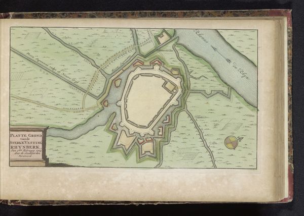
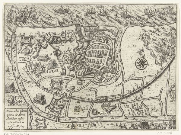
Dimensions: height 165 mm, width 264 mm
Copyright: Rijks Museum: Open Domain
This is an anonymous, undated, rendering of the Plattegrond van de vestingstad Tönning, likely made with ink and watercolour. Here, the map serves as a stark reminder of a time when geographical knowledge was synonymous with political power and military strategy. What stories are omitted when the land is reduced to lines and shapes on a page? We are invited to consider how this representation of space might reflect and reinforce the social hierarchies of its time. The cherubic figures holding the banner on the left introduce a curious tension, perhaps alluding to a divine blessing on the city's defenses, or perhaps a somber acknowledgement of the lives at stake within those walls. What did it mean to live within such a structure? What were the implications of who could and couldn't access it? The detailed fortifications and armaments signal the ever-present threat of conflict and the resources poured into maintaining a stronghold. By showing us this, the map encourages us to reflect on how the concept of "security" is crafted, controlled, and experienced differently based on one's position within the social landscape.
Comments
No comments
Be the first to comment and join the conversation on the ultimate creative platform.
More like this