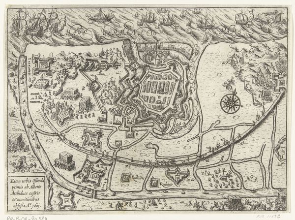
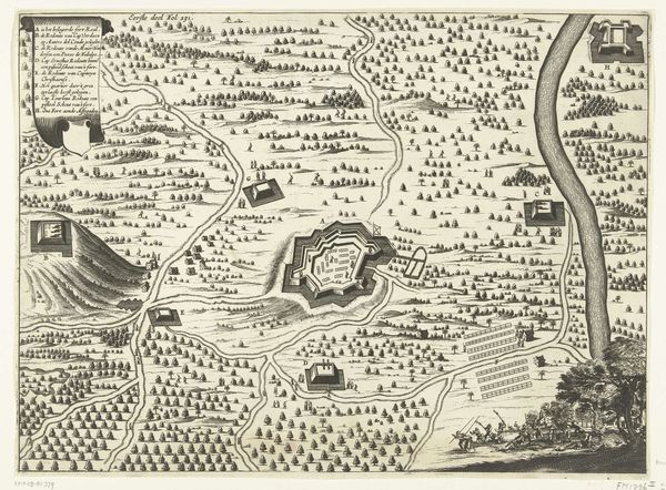
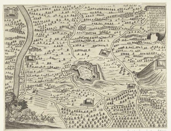
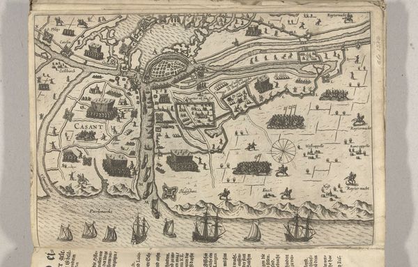
Kaart van het eiland Voorne en plattegrond van Brielle, 1572 before 1657
franshogenberg
Rijksmuseum
drawing, print, etching, ink
pen and ink
drawing
dutch-golden-age
mechanical pen drawing
pen illustration
pen sketch
etching
landscape
personal sketchbook
linework heavy
ink
sketchwork
pen-ink sketch
pen work
storyboard and sketchbook work
Dimensions: height 347 mm, width 490 mm
Copyright: Rijks Museum: Open Domain
Curator: This detailed map, titled 'Kaart van het eiland Voorne en plattegrond van Brielle, 1572' by Frans Hogenberg, is an etching made before 1657. It depicts the island of Voorne and the town of Brielle, both in the Netherlands. It's currently held at the Rijksmuseum. What catches your eye first about this bird's-eye view? Editor: The intricate linework! It almost vibrates off the page. And there's a dreamlike quality—not exactly realism, but a crafted version of a place. I feel a certain... wistful remove. Almost like looking back at a past that wasn't necessarily *my* own, but one I somehow feel connected to. Curator: Precisely. These kinds of maps weren't just geographical tools; they were potent statements. The Dutch Golden Age was booming, but this map alludes to very troubled times with the Eighty Years' War as context. Maps solidified power, defined territories during periods of unrest. Look at the ships dotting the waterways, indications of trade but also of military might. Editor: Exactly, it's strategic as well as aesthetic. I notice how the walled city of Brielle is emphasized. The island seems defined as much by waterways and fortifications as it is by fields or dwellings. How was the map perceived in a period of political upheaval? What did it mean to make claims of place in ink? Curator: Great point. Brielle held significant strategic importance. In 1572, it was captured by the Watergeuzen (Sea Beggars), a pivotal moment in the Dutch Revolt against Spanish rule. This map could’ve served as propaganda, asserting Dutch control and emphasizing Brielle as a vital stronghold, a point of pride for a nation forging its identity through rebellion. Editor: The neat rectangles suggesting agricultural land almost become symbols of order amidst conflict. It’s fascinating how cartography can render power visible through lines and shapes, effectively domesticating space and claiming dominion. It makes me wonder about marginalized communities too: Where do the landless laborers, the poor farmers, figure into this triumphant representation of land? What power structures exist between the neat agricultural areas outside the walled town, or along those active waters, inside and outside of Brielle's heavy fortifications? Curator: A vital question. The map undeniably reflects a specific, likely privileged, perspective on ownership and control, sidelining experiences of those not included in this view. Thank you for bringing to the fore how the act of mapping always carries implications of power and exclusion. Editor: My pleasure. These artifacts of visual sovereignty challenge me to ask how they define historical memory and national mythmaking—whose narratives were actively centered then and continue to be amplified today? It gives us more work to do to make it accessible for everyone!
Comments
No comments
Be the first to comment and join the conversation on the ultimate creative platform.