print, engraving
#
baroque
#
pen drawing
#
mechanical pen drawing
# print
#
pen illustration
#
pen sketch
#
old engraving style
#
landscape
#
personal sketchbook
#
pen-ink sketch
#
pen work
#
sketchbook drawing
#
cityscape
#
history-painting
#
sketchbook art
#
engraving
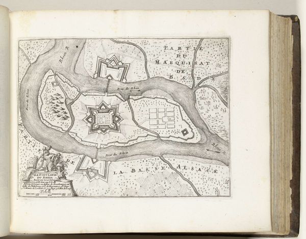
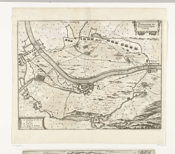
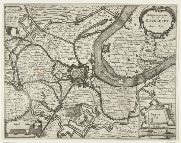
Dimensions: height 190 mm, width 265 mm
Copyright: Rijks Museum: Open Domain
This is Gaspar Bouttats’s plan of Rheinberg, made after the city's capture by the French in 1672. The composition is dominated by the river Rhine, its snaking form dividing the map and drawing the eye through the image. The schematic arrangement of fortifications, buildings, and troops creates a dense tapestry of lines and textures. What strikes me is how Bouttats uses geometric forms to represent the chaos of war. The star-shaped forts and grid-like city plans impose a sense of order on the landscape, a visual metaphor for the control exerted through military conquest. This tension between order and disorder can be read through a structuralist lens, where the map itself functions as a system of signs. Each line, shape, and label carries a specific meaning, contributing to an overarching narrative of power and domination. Note the precision of the engraving, how each stroke meticulously defines space and form. This attention to detail is not merely aesthetic; it reflects a desire to codify and control the represented territory. As we contemplate this map, we are reminded that even seemingly objective representations are embedded with ideological meaning.
Comments
No comments
Be the first to comment and join the conversation on the ultimate creative platform.
More like this