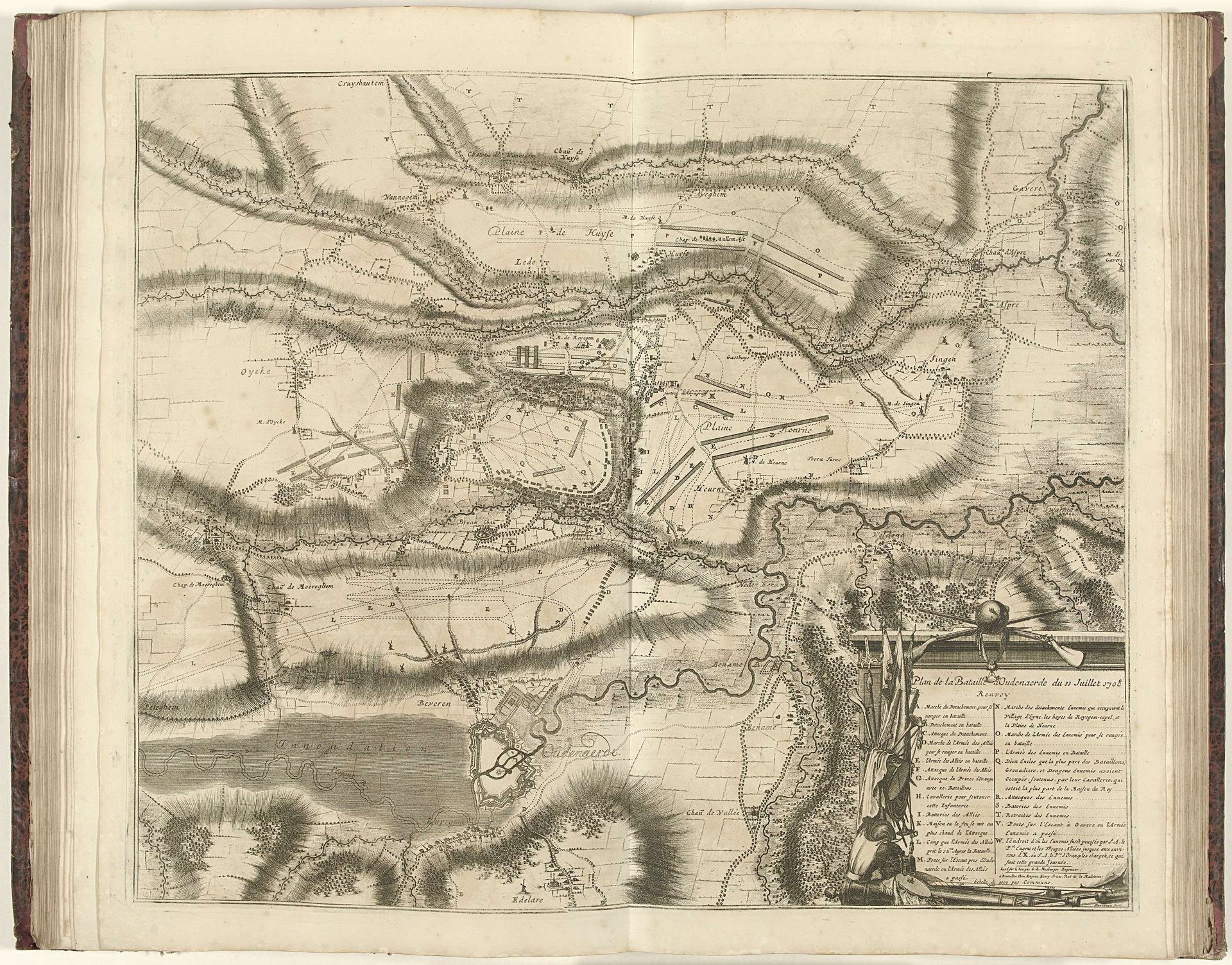
1708
Kaart van de slag bij Oudenaarde, 1708
Jacobus Harrewijn
1660 - 1732Location
RijksmuseumListen to curator's interpretation
Curatorial notes
This is Jacobus Harrewijn's engraving titled "Kaart van de slag bij Oudenaarde," created in 1708. This map depicts the Battle of Oudenaarde, a key moment in the War of the Spanish Succession, a conflict largely fought over dynastic power in Europe. Harrewijn, working in the Dutch Republic, was part of a culture deeply engaged with cartography and representation. The map flattens the landscape into a strategic overview, reducing human lives to mere troop movements. What does it mean to witness a battle rendered as a set of lines, distances, and positions? While the map emphasizes military strategy, it's also a product of its time, reflecting the Dutch Republic's preoccupation with trade and military power. Consider the emotional distance of the map-maker, abstracting violence into a carefully rendered document. Maps like these helped shape both the conduct of war and the narratives that followed, obscuring the ground-level realities of conflict.