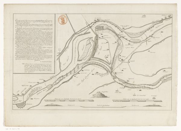
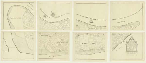
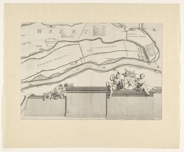
Kaart van Den Helder en een deel van Texel met het tussenliggende Marsdiep after 1688
0:00
0:00
drawing, print, etching, paper, ink
#
drawing
# print
#
etching
#
landscape
#
etching
#
paper
#
ink
Dimensions: height 314 mm, width 410 mm
Copyright: Rijks Museum: Open Domain
This is a map of Den Helder and part of Texel, including the Marsdiep, made by an anonymous artist with ink and watercolor on paper. The map's appearance is greatly influenced by the qualities of the materials used. The ink lines define the shapes of the land, while the watercolor washes fill them with color. The paper itself provides a smooth, absorbent surface that allows the ink and watercolor to flow easily, creating a sense of precision and detail. The hand-drawn nature of the map imbues it with a sense of human touch, a mark of the labor involved in its creation. The production process likely involved meticulous planning, surveying, and drafting skills. Each line, each color, represents a deliberate decision made by the artist. The map is not just a representation of the physical landscape, but also a reflection of the artist's skill, knowledge, and attention to detail. Ultimately, understanding the materials, making process, and historical context is essential for unlocking the full meaning and significance of the map.
Comments
No comments
Be the first to comment and join the conversation on the ultimate creative platform.
More like this