print, etching, engraving, architecture
#
dutch-golden-age
# print
#
etching
#
etching
#
architectural drawing
#
cityscape
#
engraving
#
architecture
Dimensions: height 233 mm, width 386 mm
Copyright: Rijks Museum: Open Domain
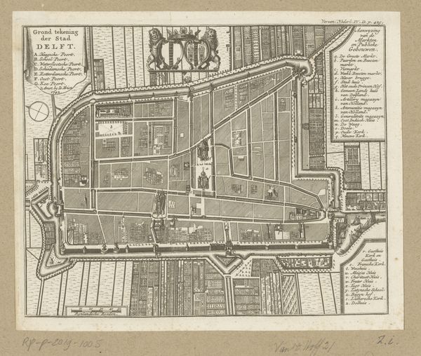
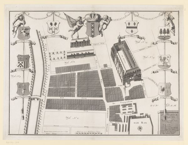
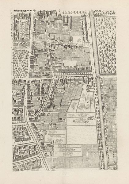
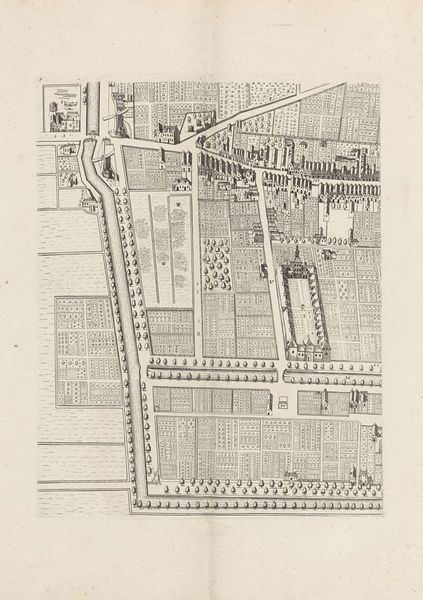
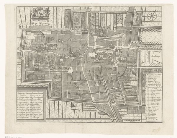
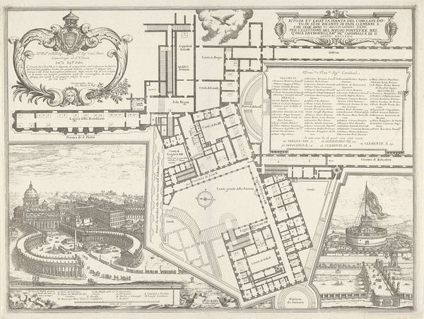
Curator: This is a fascinating print, an etched and engraved map titled "Plattegrond van Batavia," dating back to 1781. It's currently held at the Rijksmuseum. Editor: It strikes me immediately as incredibly meticulous, almost obsessively so. The density of detail gives it a rather sterile, controlled feeling, despite being a cityscape. You can almost smell the ink and imagine the precise movements of the engraver's tools. Curator: Exactly. The print offers more than just a representation of the city. Its creation speaks volumes about Dutch colonial power during the Golden Age, presenting Batavia, now Jakarta, as an orderly, planned space under Dutch control. Think of it as visual propaganda. Editor: The grid structure really emphasizes that control, doesn't it? The way everything is laid out in these neat little boxes. The waterways forming its edges remind us of how infrastructure shaped colonial power. The materials used - the paper, ink, metal plates - all required extraction, production and labour to produce, echoing trade routes. Curator: And that control extended beyond the purely architectural. These city plans often dictated social hierarchies, dictating where different groups could live and conduct business. They represent not just the physical city but the societal structures the colonizers wished to enforce. The etching and engraving medium, repeatable and portable, allows it to disseminate Dutch ideals far and wide. Editor: You're right, it's fascinating how something so seemingly objective can be so laden with ideology. The print almost seems devoid of life at street level. What would a laborer have thought of such an idealized version of their urban landscape? This sharp contrast between high and low, the meticulous mapmaking and lived experience on the ground, I wonder what that must have been like? Curator: Indeed, that tension between the plan and reality is crucial. While seemingly neutral, maps are tools, they advance very specific interests and shape understanding, so considering what these prints omit is as important as understanding their contents. Editor: It is a cold beauty but, knowing the colonial story it tells through the sharp lines and deliberate organisation, offers an insight into how the Dutch envisioned not just a city, but an empire. Curator: Yes, studying objects like this allows us to critically examine the lasting impacts of colonialism, visible in these kinds of seemingly simple depictions of cityscapes.
Comments
No comments
Be the first to comment and join the conversation on the ultimate creative platform.
More like this