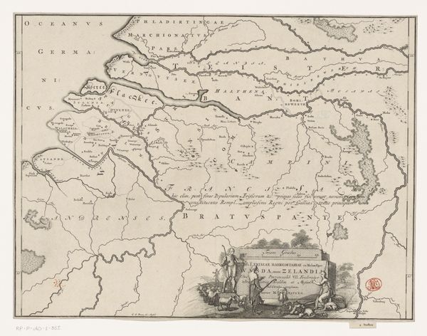
Historische kaart van Nederland met de gebieden van de Bataven en Friezen 1697 - 1725
0:00
0:00
jangoeree
Rijksmuseum
graphic-art, print, engraving
#
graphic-art
# print
#
landscape
#
history-painting
#
engraving
Dimensions: height 317 mm, width 420 mm
Copyright: Rijks Museum: Open Domain
This historical map of the Netherlands, showing the lands of the Batavi and Frisians, was created by Jan Goeree around the turn of the 18th century. It reflects a growing sense of Dutch national identity, one deeply rooted in classical antiquity. Goeree’s image creates meaning by associating the Dutch with the Batavians and Frisians. We can see it in the heroic figures and Latin inscriptions typical of classical imagery. The map's aesthetic suggests a self-conscious attempt to legitimize the Dutch Republic through historical narrative. In doing so it links contemporary political boundaries with ancient tribal territories. This can be read as a progressive, even revolutionary statement, as it constructs an image of a unified Dutch people with a lineage that predates the authority of the Spanish crown. To understand the map's full significance, scholars consult historical texts, archaeological records, and studies of Dutch nationalism. This interdisciplinary approach reveals the powerful role of art in shaping national consciousness.
Comments
No comments
Be the first to comment and join the conversation on the ultimate creative platform.
More like this