drawing, print, paper, ink, engraving
#
drawing
#
baroque
# print
#
paper
#
ink
#
geometric
#
cityscape
#
engraving
Dimensions: height 200 mm, width 280 mm
Copyright: Rijks Museum: Open Domain
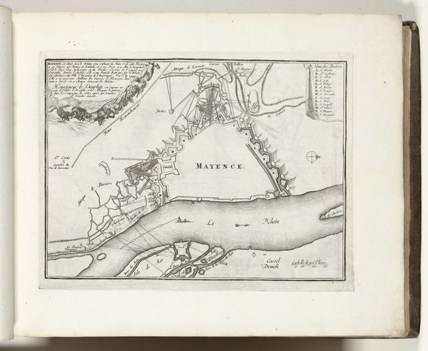
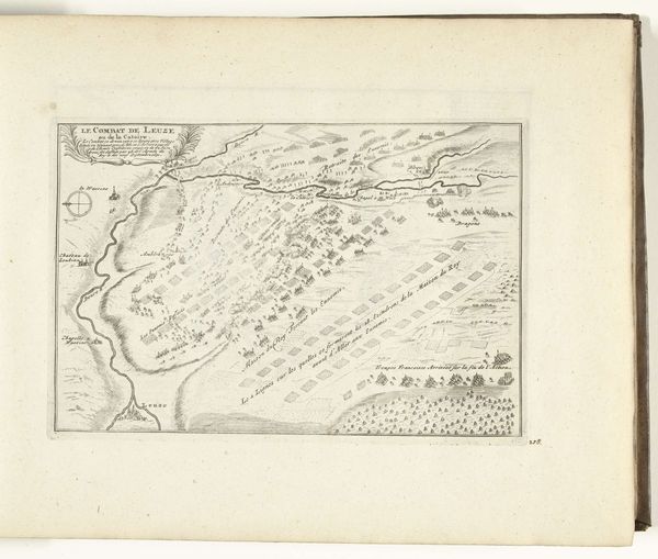
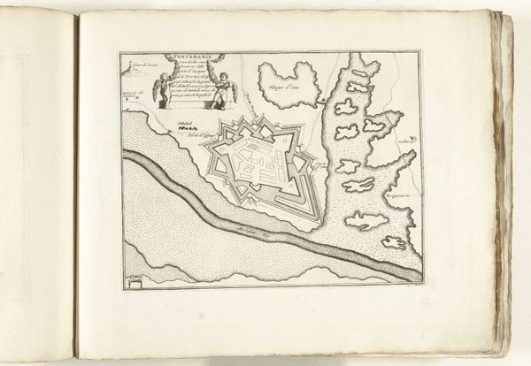
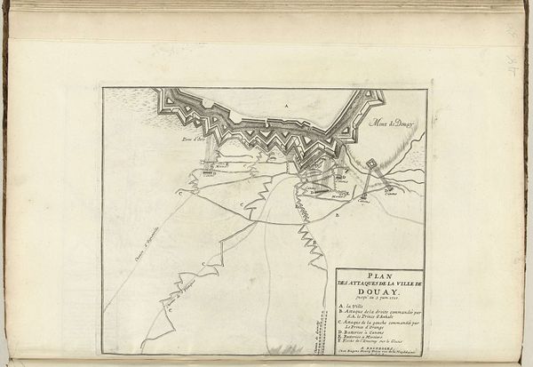
Curator: At first glance, the neutral palette suggests an age of reason and military pragmatism. There's an eerie calm in the ordered lines, the river snaking its way, bisecting what’s charted. Editor: Precisely! This print, dating back to around 1702, depicts a bird’s-eye view of Mainz. It’s done in ink and engraving on paper. Note how the Baroque fascination with order translates into urban planning, or, shall we say, strategies of control and defense. Curator: Yes, the lines radiating outward might suggest networks—of power, perhaps, but I'm drawn to how the cartographer depicts buildings, as almost symbolic forms rather than accurate portrayals. They strike me as emblems or signifiers. The details around the town planning certainly bring attention to the symbolic. Editor: A fascinating reading, drawing out those underlying systems. Let’s consider this from a sociopolitical angle; maps weren't merely about geographic accuracy. They reflected, and still reflect, power structures, land ownership, and even colonial ambitions. In whose interest was this plattegrond made? Curator: Possibly, a prince seeking stability, with each outlined building marking civic importance. I see the gridwork not as inherently oppressive, but a visual representation of shared understanding, each building having significance. And consider the compass rose, how it suggests all points accessible, everything orientable within a structure. Editor: While I appreciate your point about shared understanding, it’s essential to be critical. A plattegrond like this often neglects the experiences of marginalized communities. It renders a city as a neat, manageable entity for those in charge. It masks the informal, vibrant lives pulsing underneath the carefully inscribed buildings. What about those excluded from representation on this “rational” map? Curator: That’s a vital perspective, to look beneath the surface and see absence where presence is proclaimed. For me, what persists are symbols—the bridge becoming a literal connection point, promising interaction and possibly conquest. And the church, looming above everything, marking that connection with higher order and thought. Editor: A visual reminder that any representation is indeed selective and rooted in a specific point of view. Thank you for your interpretation and attention to symbols within, perhaps encouraging further thought and questions about urban representation even now. Curator: Thank you. These dialogues across time, etched in symbolic spaces, remind us of the complex layers shaping any place we try to map or know.
Comments
No comments
Be the first to comment and join the conversation on the ultimate creative platform.
More like this