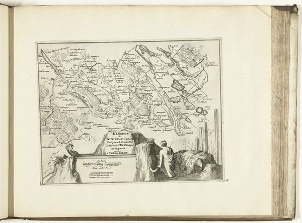
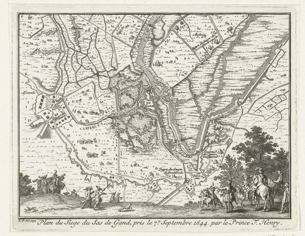
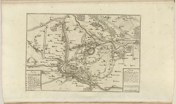
Kaart van het nieuwe kanaal van Pontgouin naar Versailles (deel III), ca. 1702 1702 - 1703
0:00
0:00
anonymous
Rijksmuseum
print, engraving
#
baroque
# print
#
landscape
#
line
#
cityscape
#
history-painting
#
engraving
Dimensions: height 204 mm, width 260 mm
Copyright: Rijks Museum: Open Domain
Curator: Here we have an engraving from around 1702, titled "Kaart van het nieuwe kanaal van Pontgouin naar Versailles (deel III)," which translates to "Map of the new canal from Pontgouin to Versailles (part III)." It is held in the collection of the Rijksmuseum. Editor: It's visually quite striking, isn't it? A peculiar blend of cartographic precision and almost theatrical staging, giving the entire map a peculiar, dramatic weight. The linear quality is very evident here; quite precise and exacting in its construction. Curator: Absolutely. The rigid structure lends itself to a fascinating duality. On the one hand, you have an almost scientific rendition of landscape and on the other, these allegorical figures integrated at the base. I think their presence offers a vital commentary on our cultural relationship with waterways. We can trace the use of figures within mapping to classical forms; a connection made explicit with their inclusion here. Editor: They become almost like personifications, don't they? I’m wondering if they are allusions to ancient water deities or, perhaps, more directly represent the human ingenuity and labour required for such a large-scale feat of engineering? Given that we know this to be associated with Louis XIV’s need for water at Versailles. Perhaps these figures serve as symbols of that power? Curator: It’s plausible. Notice how the graphic nature of the print emphasizes specific components and landmarks along the route? These deliberate points provide clear structure for navigation and help create a conceptual understanding for contemporary audiences. It allows the print to go beyond simply being an artistic rendering of geography. It emphasizes its role in shaping human-land relationships, if you will. Editor: It brings a compelling story to life, in effect. Considering it as a kind of symbolic journey where culture shapes nature and nature in return reflects the image and grandeur of those commissioning these ambitious projects. Curator: I agree. It offers a rather unique commentary. Editor: A most intriguing visual synthesis.
Comments
No comments
Be the first to comment and join the conversation on the ultimate creative platform.
More like this