print, engraving
# print
#
engraving
Dimensions: height 186 mm, width 230 mm
Copyright: Rijks Museum: Open Domain
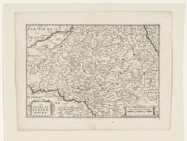
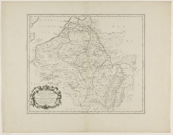
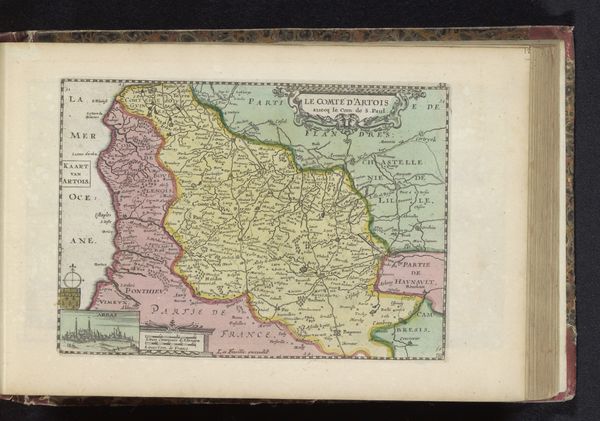
Curator: This print is a rather understated "Kaart van Duitsland," or Map of Germany, dating back to 1774, by an anonymous artist. The medium is listed as engraving, a technique that allows for precise detail, as we see here. Editor: You know, it strikes me immediately as a ghostly echo of boundaries. I find myself instinctively tracing those delicate lines, those borders… There’s such a sense of transience about it all. Like looking at a fossil of a nation-state. Curator: That sense of transience is quite pertinent. Maps, by their very nature, are reflections of political power at a specific moment. Boundaries shift, names change...it reflects cultural memory itself as something fluid. Editor: Exactly! It makes you wonder, what did "Germany" mean in 1774? Was it a shared language? A cultural kinship? Looking at those tight little letters crowded onto the page feels like trying to decipher a dream. Curator: In the 18th century, Germany was far from a unified nation. It consisted of a patchwork of independent states, free cities, and territories within the Holy Roman Empire. So what you see here isn't so much a cohesive country, but more a region—a conceptual space with its own historical resonance. It speaks to a collective longing before unification. Editor: And the scale is interesting too – it feels strangely intimate, like holding history in your hands. And that aging paper, its imperfections only enhance the idea of something that once was. It provokes a curiosity about everything absent or obscured from these neatly-etched details. Curator: Precisely, it emphasizes the incompleteness of all our maps and national narratives. It gives pause for thought about what it means to make territorial claims when they are, in themselves, historically situated and dependent on prevailing political arrangements. Editor: Looking at this intricate network, those fragile demarcations… I’m realizing these old maps don’t just show us where places are; they show us who we thought we were, or wished to be, at a certain point in time. A real testament to that perpetual human quest for identity, or perhaps simply for somewhere to belong. Curator: Indeed. The image is of value because it demonstrates how a geographical representation of a region can reveal as much about political ideas and their evolution as they can delineate terrestrial characteristics.
Comments
No comments
Be the first to comment and join the conversation on the ultimate creative platform.
More like this