drawing, print, ink, engraving
#
drawing
#
pen drawing
# print
#
ink
#
cityscape
#
engraving
Dimensions: height 222 mm, width 317 mm
Copyright: Rijks Museum: Open Domain
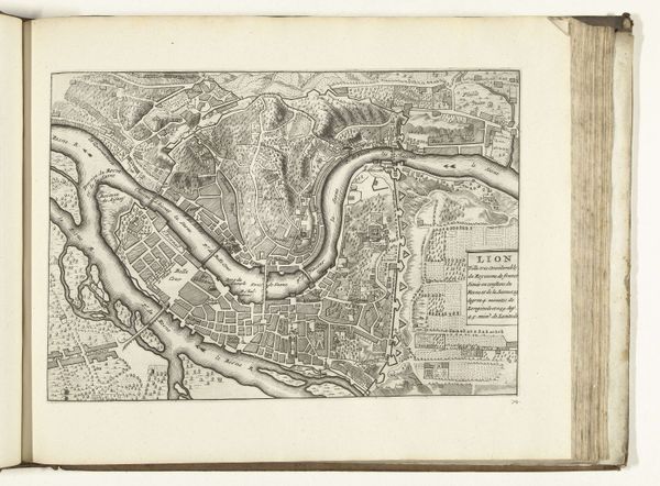
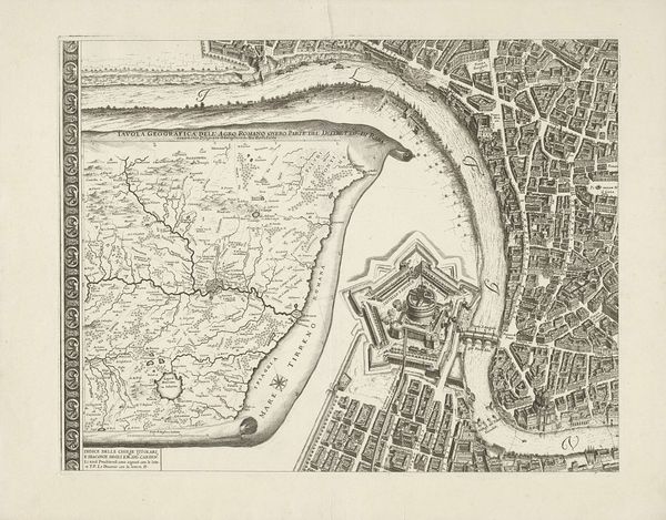
This print, made around 1702 by an anonymous maker, depicts a bird’s-eye view of Lyon. It was made using a process called engraving, a printmaking technique where lines are incised into a metal plate, which is then inked and pressed onto paper. The sharp precision of engraving allows for a detailed representation of the city's layout, with its architecture, waterways, and fortifications. This wasn't just about aesthetics. Maps like these were crucial tools for urban planning, military strategy, and navigation. The act of mapping itself was a form of control, a way of visually organizing and understanding space. Consider the labor involved: the skilled engraver meticulously carving the design, the printers producing multiple copies, and the distributors circulating the image. The print is not just a representation of Lyon, but a product of complex social and economic systems. By focusing on the processes and materials, we can see how this seemingly simple map connects to broader issues of labor, power, and knowledge in the 18th century.
Comments
No comments
Be the first to comment and join the conversation on the ultimate creative platform.
More like this