drawing, print, paper, ink, engraving
#
drawing
#
baroque
# print
#
paper
#
ink
#
geometric
#
cityscape
#
history-painting
#
engraving
Dimensions: height 212 mm, width 265 mm
Copyright: Rijks Museum: Open Domain
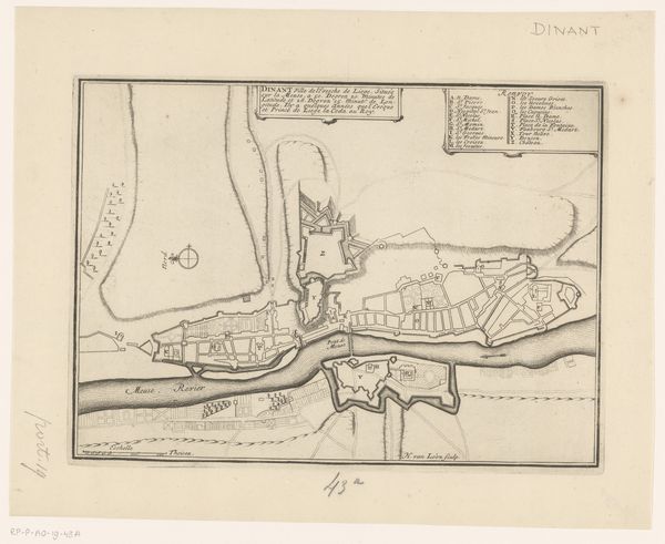
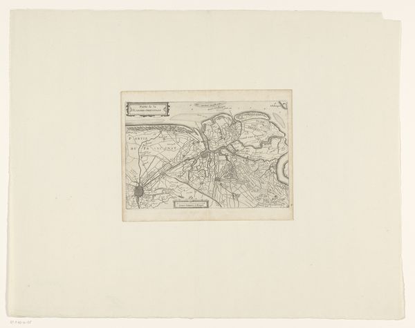
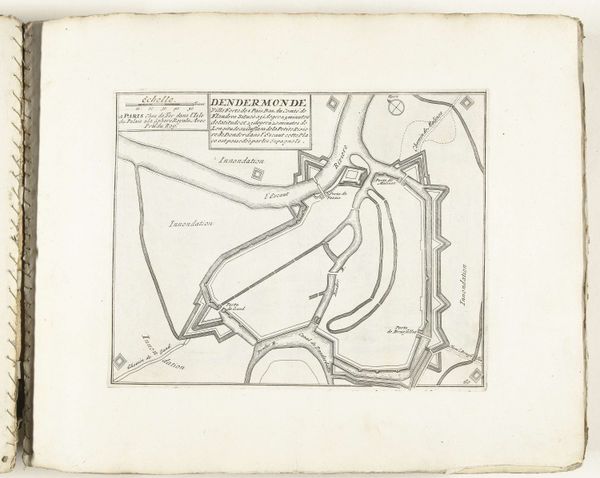
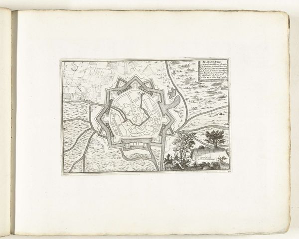
Curator: Let's discuss this intriguing print: a "Vestingplattegrond van Homburg," a detailed fortification plan of Homburg, dating from around 1700 to 1728, by an anonymous artist. It is rendered in ink on paper through engraving. Editor: My initial response is how incredibly geometric and precise this image feels. It's almost architectural in its intensity of line and shape. The limited tonal range highlights the spatial structure. Curator: Absolutely, and that reflects the practical purpose behind its creation. Fortification plans like this were critical military and administrative tools in the early 18th century. It showcases the layout for defense strategies. Homburg was a strategically important location; mapping it thoroughly was essential for its governance and protection against potential invaders. The map itself would likely have served both political and symbolic roles for authorities and military elites alike. Editor: I'm drawn to the tension created by the organic landscape details around the fortress's hard lines. The trees seem softer, even whimsical in comparison to those rigidly organized structures. Also, note the lines indicating fields outside. The artist juxtaposes organic against highly geometric forms, producing dynamism in what might have otherwise been a very functional artifact. Curator: Yes, this tension indicates the period's emerging consciousness of natural resources as both something to be mastered and a beautiful component of territorial possession. Note how even those "whimsical" trees fall neatly within implied lines of property. Moreover, consider this image’s circulation – engravings allowed for relatively easy duplication, democratizing information about state power, but also spreading expertise in military engineering to allies and rivals alike. Editor: Considering those tight compositions within set parameters I began to see it almost as an abstract exploration of shape and form, and that, for me, elevates the functional purpose of this print to something more aesthetically complex. The negative space is used just as decisively as the inked lines. Curator: Agreed. The map reflects societal transformations and shifting ideas about spatial relationships during a crucial era. Now when viewed it prompts thoughtful reflections on governance, knowledge dissemination, and militarization throughout that time. Editor: Indeed, by carefully parsing form and visual cues, it provides insights into both aesthetic intent and social narrative present inside the Vestingplattegrond van Homburg.
Comments
No comments
Be the first to comment and join the conversation on the ultimate creative platform.
More like this