graphic-art, print, engraving
#
graphic-art
#
dutch-golden-age
# print
#
old engraving style
#
cityscape
#
engraving
Dimensions: height 336 mm, width 188 mm
Copyright: Rijks Museum: Open Domain
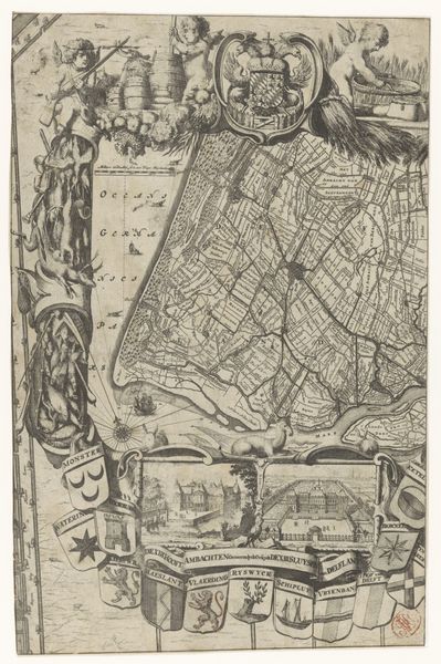
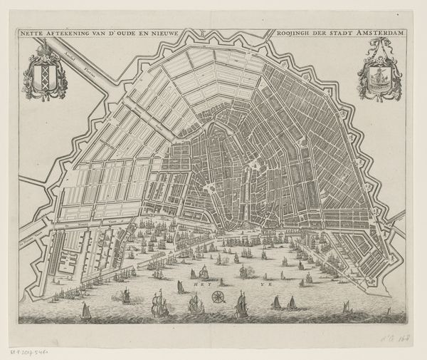
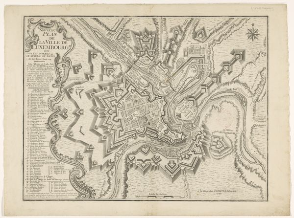
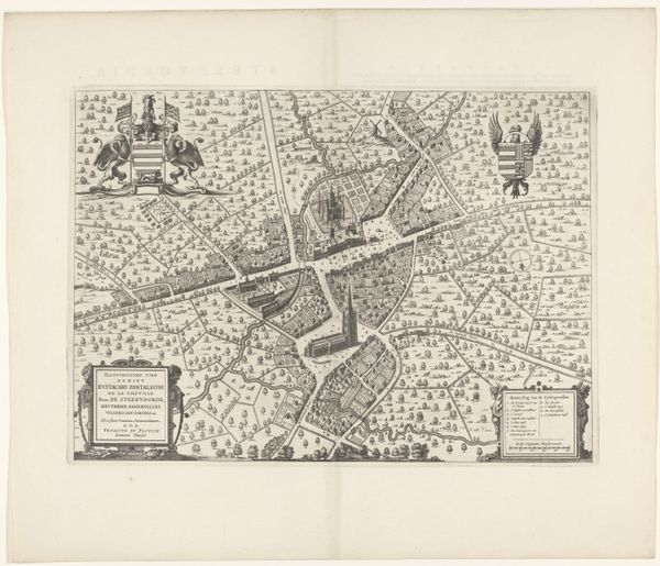
Editor: Here we have "Plattegrond van Amsterdam, 1612", or "Map of Amsterdam", an engraving from the Dutch Golden Age, attributed to Abraham Hogenberg. The fine lines detailing the city's layout are really striking! What sort of stories do you think this cityscape can tell us? Curator: This image is teeming with silent narratives, Editor. Notice the prominent placement of the city's fortifications. What emotions might those trigger for a 17th-century viewer? Consider also the figures in the lower corner. How does their presence influence your understanding of the city’s self-image? Editor: I guess they symbolize commerce and trade, as these are pretty well-to-do individuals. The walls... perhaps suggest a place to conduct those commercial endeavors safely. Curator: Precisely! And delve deeper: The lion rampant on the shield… can you think of other symbolic uses for Lions that preceded its integration into the municipal or state identity? What memories were people drawing on in deciding on that imagery? Editor: I am not sure, that is fascinating to think about, but I don’t know where I’d begin… Curator: Symbols aren't born in a vacuum. Cultural memory infuses every element. Even a seemingly straightforward city plan echoes with meaning if you ask the right questions! Thinking about visual rhetoric really does change how one sees and values images and art. Editor: Wow, I will have to think more about visual rhetoric to explore how to interpret it. Thank you, I appreciate it.
Comments
No comments
Be the first to comment and join the conversation on the ultimate creative platform.
More like this