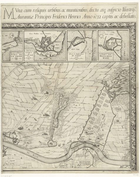
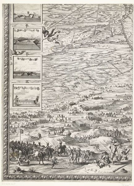
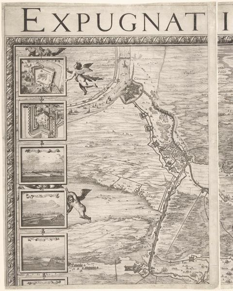
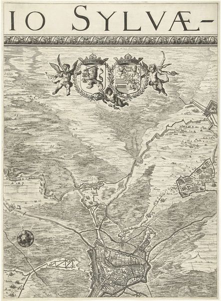
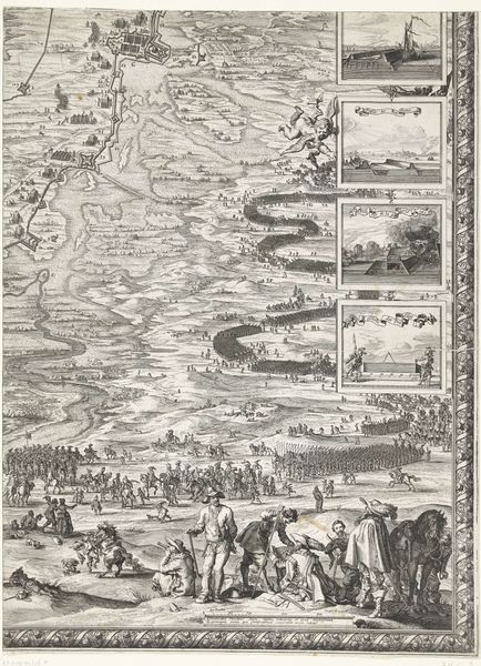
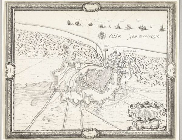
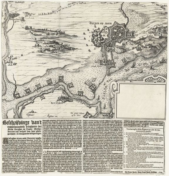
Grote kaart van het beleg van Den Bosch door Frederik Hendrik (blad rechtsboven), 1629 1629
0:00
0:00
salomonsavery
Rijksmuseum
print, engraving
#
baroque
# print
#
landscape
#
cityscape
#
engraving
Dimensions: height 652 mm, width 448 mm
Copyright: Rijks Museum: Open Domain
Curator: Look at this engraving, "Grote kaart van het beleg van Den Bosch door Frederik Hendrik," or "Large map of the siege of Den Bosch by Frederik Hendrik," created by Salomon Savery in 1629. Editor: My first impression is one of precision and detail. It's like a meticulously rendered bird's-eye view. I wonder about the human cost represented so clinically? Curator: Indeed, the engraving masterfully combines detailed topographic mapping with artistic flair typical of Baroque landscapes. The use of line and perspective creates a structured, yet somewhat ethereal representation of space. Editor: And the scale! Enormous labour must have gone into creating this. It forces me to consider the materials used – the paper, the ink, the metal plate used for the engraving itself, the craftsman skills and their place within the economy of the time. What about the social and political drivers that commissioned such detailed pieces? Curator: The artist’s use of allegorical elements, the cherubs framing miniature vignettes, creates layers of symbolic depth. One could argue these devices function to ennoble the scene, transmuting what was surely an agonizing battle into a feat of divine will. The cherubs themselves suggest an idealized version of events, framing and perhaps even glorifying the acts depicted. Editor: Exactly, so where was this image intended to circulate? The work itself would certainly have been viewed within specific elite social circles. The sheer act of creating and then sharing something of this size indicates resources and an intentional channeling of effort. Curator: I'm particularly struck by how the artist organized this representation within distinct pictorial registers. There's a hierarchy established that directs our gaze, starting with the global perspective and descending toward specific landmarks. Editor: Yes, analyzing through a materialist lens gives insight into how map-making served concrete social and political objectives in the 17th century, offering invaluable information about how visual art became an indispensable part of a sophisticated administrative structure. Curator: Well, by exploring the structure of the engraving, we unveiled strategies of spatial representation employed during the period, along with underlying messages encoded by the engraver himself. Editor: Right, and by diving into the materiality of this object, we shed light on a nexus of technology, craft, and cultural meaning tied together within its production.
Comments
No comments
Be the first to comment and join the conversation on the ultimate creative platform.
More like this