drawing, print, etching, ink, engraving
#
drawing
# print
#
etching
#
ink
#
geometric
#
cityscape
#
engraving
Dimensions: height 553 mm, width 640 mm
Copyright: Rijks Museum: Open Domain
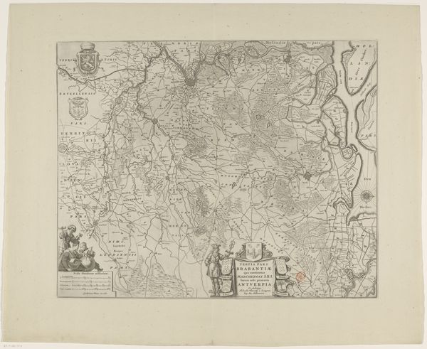
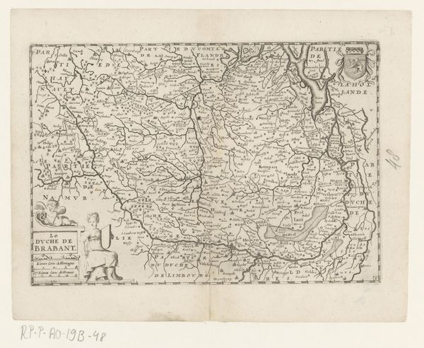
Cornelis van Baarsel made this map of Brabant in the late eighteenth or early nineteenth century using engraving. Brabant was a contested region between the Dutch Republic and the Spanish Netherlands, and mapmaking was a way of laying claim to territory, defining borders, and asserting power. The image creates meaning through visual codes; two seated female figures on either side of the title might represent the region's classical or mythical origins. Cartography in the Dutch Republic was linked to its economic and political power, and the province of Brabant was the site of ongoing conflict. This map embodies the tension between the Dutch Republic's self-image as a modern, rational state and the contested nature of its borders and colonies. The map also emphasizes the importance of geography, trade, and military strategy in shaping the region's identity. To understand better the map's significance, we might consult historical atlases, military records, and economic data from the period. The meaning of art is always contingent on its social and institutional context.
Comments
No comments
Be the first to comment and join the conversation on the ultimate creative platform.
More like this