print, engraving
#
baroque
# print
#
cityscape
#
engraving
Dimensions: height 365 mm, width 468 mm
Copyright: Rijks Museum: Open Domain
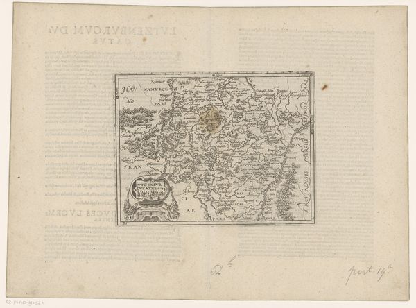
This is an anonymous map of the Duchy of Luxembourg. At the bottom left, one finds the crowned coat of arms, featuring a lion rampant, which has served as a symbol of Luxembourg for centuries. The lion as a symbol of power and courage dates back to antiquity. In many cultures, from ancient Egypt to the Near East, it represented royalty and divine strength. The lion's presence on Luxembourg's coat of arms connects to a long line of heraldic traditions, symbolizing the duchy's sovereignty and authority. Even today, the lion persists in popular culture, evoking a sense of bravery and nobility in sports teams, national emblems, and corporate logos. Note how the crowned lion continues to echo through the ages, its primal force undiminished, its symbolism resilient, adapting to different cultural landscapes yet always resonating with fundamental human perceptions of power.
Comments
No comments
Be the first to comment and join the conversation on the ultimate creative platform.
More like this