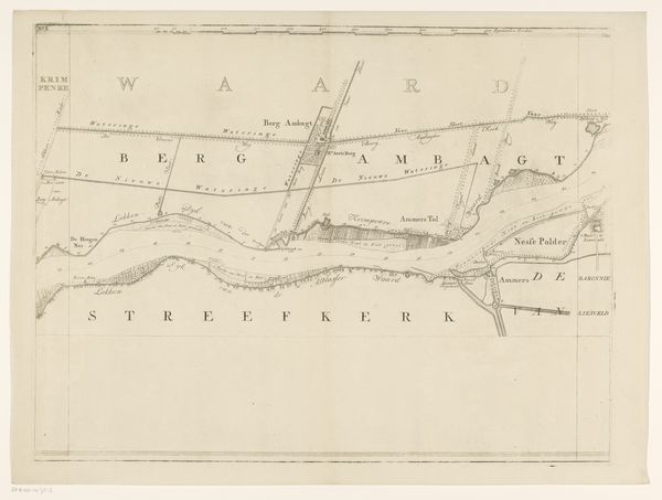
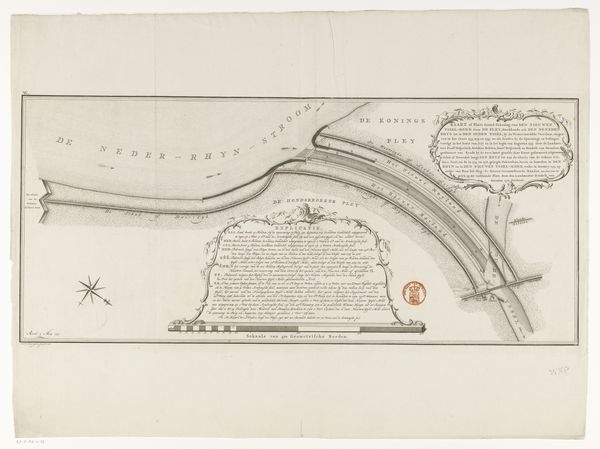
Doorbraak van den Vlijmensche Dijk ten zuiden Nieuwkuik ten 2 ure des nachts van 29 op 30 December 1880 1880
0:00
0:00
drawing, print, etching
#
drawing
# print
#
etching
#
landscape
#
etching
#
realism
Dimensions: height 574 mm, width 900 mm
Copyright: Rijks Museum: Open Domain
This map, created by B. Brouwer & Co, documents the Vlijmensche Dyke breach south of Nieuwkuik at 2 AM on December 29-30, 1880. It's a fascinating look into a moment of crisis and the human effort to control nature. This event took place during a time of significant advancements in engineering and water management in the Netherlands, yet nature's power could still disrupt human plans. The map meticulously records the breach and its impact, but it also symbolizes a broader struggle – the relationship between the Dutch people and the water that both threatens and sustains them. Notice how the map details not just the physical rupture but also the infrastructure around it. The text around the edges outlines the causes and effects of the breach in the dike. In that sense, it is also a narrative of resilience. What does it mean to rebuild after such a disaster? How does a community come together in the face of such overwhelming forces? It's a reminder of our constant negotiation with the environment and each other.
Comments
No comments
Be the first to comment and join the conversation on the ultimate creative platform.
More like this