print, ink, engraving
#
dutch-golden-age
# print
#
old engraving style
#
ink
#
geometric
#
cityscape
#
history-painting
#
engraving
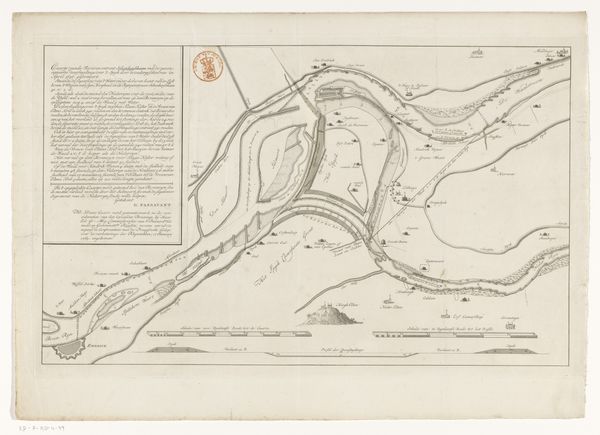
Dimensions: height 430 mm, width 561 mm
Copyright: Rijks Museum: Open Domain
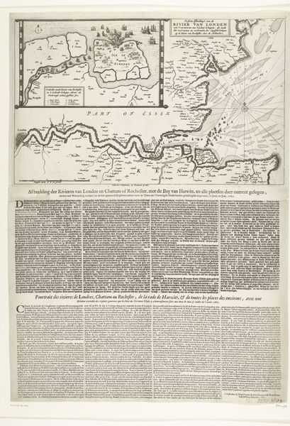
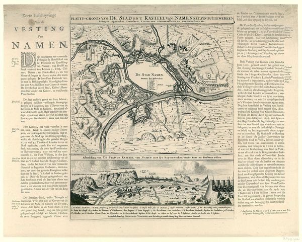
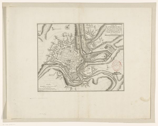
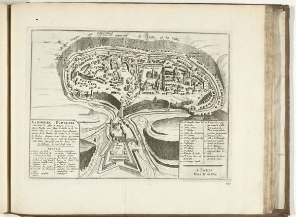
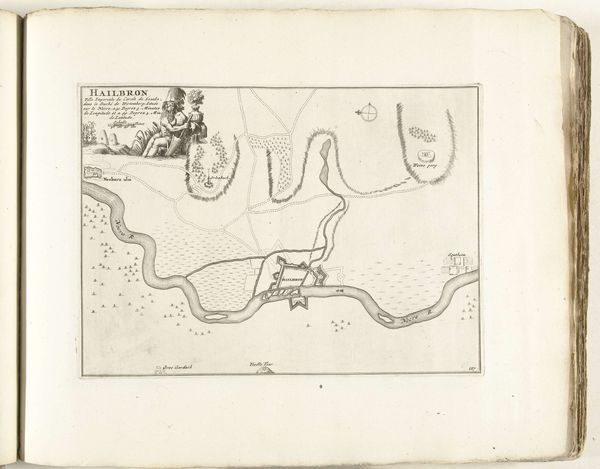
Editor: This engraving, "Kaart van het beleg van Londonderry, 1689," dating from 1689 and held at the Rijksmuseum, gives a bird's-eye view of a cityscape under siege. I’m immediately struck by the stark contrast between the rigid geometric shapes of the fortifications and the more organic curves of the river. It’s like order against chaos. What can you tell me about the historical context that shaped this image? Curator: That tension between order and chaos speaks volumes about the moment this map represents. It was produced during the Williamite War in Ireland, and Londonderry's resistance to James II’s forces became a key symbolic event. Think about the political messaging embedded within such an image. How does the map, ostensibly an objective representation of the siege, participate in constructing a narrative of Protestant resilience? Editor: I see what you mean. It's not just a factual record; it's propaganda, almost. The clear depiction of the city's layout, and the surrounding forces makes it feel strategic, but there's also that underlying message about enduring a siege. What role did these images play in shaping public opinion back then? Curator: Maps like these were powerful tools for shaping public perception, particularly in urban centers like Amsterdam, where this was printed. They visually communicated the progress of the war, reinforced ideas about national identity, and influenced popular support for particular political factions. Consider also, the role of the printing press. These images were not passively consumed; they were circulated, debated, and incorporated into a broader political discourse. Whose story is being told here, and who gets to tell it? Editor: So, it’s less about geographical accuracy and more about constructing a specific narrative. That definitely shifts how I see it. It is a strong argument for considering art’s role within political landscapes, both present and past. Curator: Precisely. Understanding the historical context helps us to deconstruct the intended messages and reveal the complex interplay between art, politics, and society. Looking at it, its value lies less in cartography and more in understanding 17th-century European social and political perspectives.
Comments
No comments
Be the first to comment and join the conversation on the ultimate creative platform.
More like this