print, etching, architecture
#
dutch-golden-age
# print
#
etching
#
landscape
#
etching
#
geometric
#
cityscape
#
architecture
Dimensions: height 126 mm, width 168 mm
Copyright: Rijks Museum: Open Domain
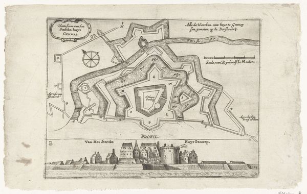
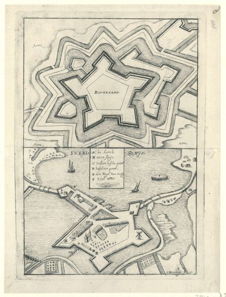
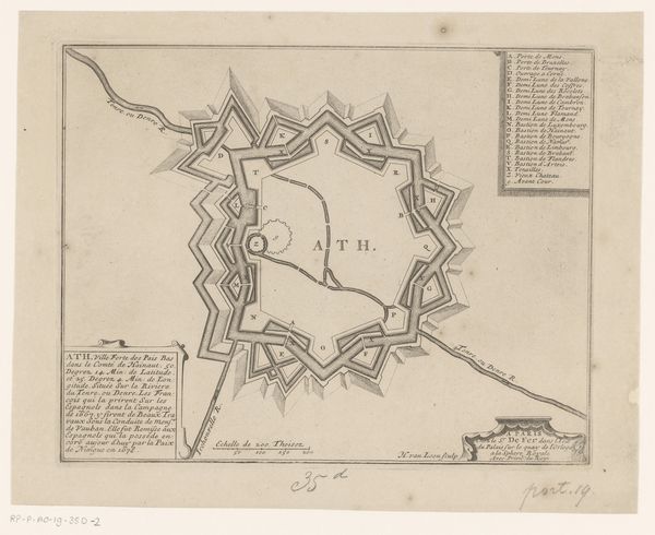
Curator: Looking at this etching, "Vestingplattegrond van Fort Sint-Andries," dating from 1653 to 1672 and attributed to Nicolaes van Geelkercken, one immediately observes the level of detailed labor required for its production. The meticulous etching technique really brings the fort’s construction to life. Editor: It strikes me as very diagrammatic. Stark even. Almost feels like a blueprint rather than an image intended for aesthetic appreciation. Very functional. Curator: Function was paramount in Dutch Golden Age prints like this. Consider that etchings and prints allowed for wide distribution. It wasn’t about "art" as high culture; it was a mode of disseminating information, especially regarding military installations such as this fortification and the Dutch landscape and territory under their power. We see this reflected in the clean, efficient lines. Editor: You are spot-on. The fort's strategic position is the central narrative here. How the built environment is shaped by historical forces and geopolitical strategies of that time and place is pretty evident. Curator: Exactly! We have the architectural specifics represented, as well as a lone sailboat—a tiny acknowledgement of maritime commerce so essential for Dutch prosperity in this era. Also consider, of course, the availability of materials; copper for the plates would need to be imported. Its availability, affordability and production quality of course would impact the overall etching process itself, too. Editor: The map speaks volumes about Dutch power during the Golden Age and its visual representation within broader political and societal narratives. Curator: By dissecting it – the production process and materials alongside the image’s social context – it brings greater complexity, challenging a straightforward consumption of a “landscape." Editor: It really goes to show that sometimes, a seemingly straightforward visual representation can offer an intriguing snapshot of societal values, military, economic drivers, and labor. Curator: Precisely. Analyzing materials helps uncover historical relationships that can alter traditional aesthetic interpretations.
Comments
No comments
Be the first to comment and join the conversation on the ultimate creative platform.
More like this