About this artwork
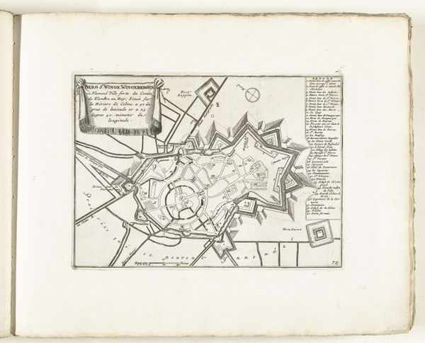
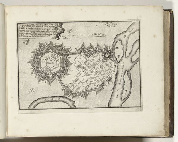
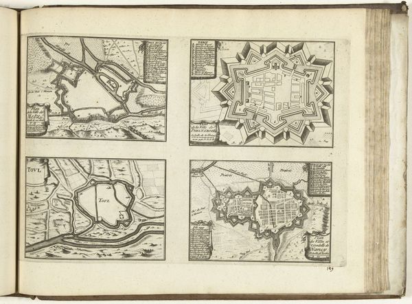
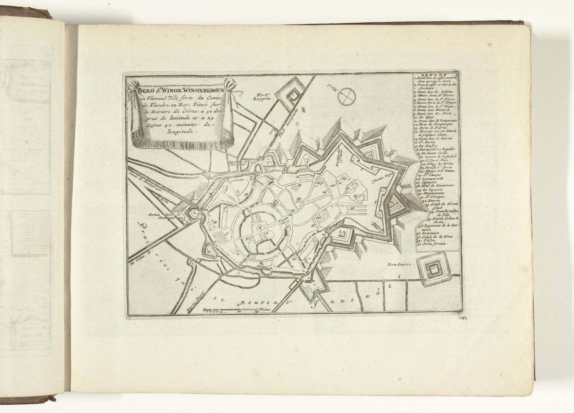
This is an engraved map of Sint-Winoksbergen, made in 1726 by an anonymous artist. The precise, linear quality of the print speaks to the engraver's skill, carefully incising lines into a copper plate. Ink was then applied, and the image transferred to paper under great pressure. This process allowed for the relatively efficient production of multiple copies, essential for distributing knowledge and reinforcing power in the 18th century. The map itself is a fascinating artifact, a tool for control and a symbol of authority. Note how the city is depicted with an emphasis on its fortifications, reflecting the military concerns of the time. The act of mapping transforms space into a commodity, a resource to be managed and defended. Consider the labor involved in both creating the physical map and constructing the city it represents. Both are products of human effort, embedded in a network of social and economic relations. By appreciating the making of this map, we come to see it as more than just a representation, but as a material object with its own history and significance.
Artwork details
- Medium
- drawing, print, paper, ink, engraving
- Dimensions
- height 201 mm, width 275 mm
- Location
- Rijksmuseum
- Copyright
- Rijks Museum: Open Domain
Tags
drawing
landscape
paper
ink
geometric
pen work
cityscape
history-painting
academic-art
engraving
Comments
No comments
About this artwork
This is an engraved map of Sint-Winoksbergen, made in 1726 by an anonymous artist. The precise, linear quality of the print speaks to the engraver's skill, carefully incising lines into a copper plate. Ink was then applied, and the image transferred to paper under great pressure. This process allowed for the relatively efficient production of multiple copies, essential for distributing knowledge and reinforcing power in the 18th century. The map itself is a fascinating artifact, a tool for control and a symbol of authority. Note how the city is depicted with an emphasis on its fortifications, reflecting the military concerns of the time. The act of mapping transforms space into a commodity, a resource to be managed and defended. Consider the labor involved in both creating the physical map and constructing the city it represents. Both are products of human effort, embedded in a network of social and economic relations. By appreciating the making of this map, we come to see it as more than just a representation, but as a material object with its own history and significance.
Comments
No comments