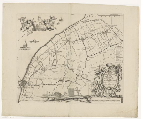
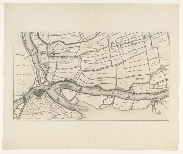
Kaart van de Alblasserwaard en de Vijfheerenlanden (deel rechtsonder) 1681 - 1716
0:00
0:00
bastiaenstopendael
Rijksmuseum
graphic-art, print, engraving
#
graphic-art
#
dutch-golden-age
# print
#
landscape
#
engraving
Dimensions: height 340 mm, width 593 mm
Copyright: Rijks Museum: Open Domain
Bastiaen Stopendael created this segment of a map of Alblasserwaard and Vijfheerenlanden, though the exact date remains unknown. This detailed map invites us to consider the relationship between land, power, and identity in the Dutch Republic. During Stopendael's time, the Netherlands was a major maritime power, deeply invested in trade, exploration, and, of course, cartography. Maps were not just geographical tools but also assertions of ownership and control. This particular map highlights the Alblasserwaard and Vijfheerenlanden regions, areas known for their complex water management systems. These systems were crucial not only for agriculture, but also for defense. The act of mapping itself was an exercise in power, defining territories and shaping perceptions. Stopendael’s map offers a glimpse into how the Dutch understood and represented their world, emphasizing the economic and strategic importance of these regions. It is a reminder that even seemingly objective representations of space are deeply intertwined with cultural, political, and economic interests.
Comments
No comments
Be the first to comment and join the conversation on the ultimate creative platform.
More like this