drawing, print, ink, engraving
#
drawing
#
aged paper
#
dutch-golden-age
# print
#
pen illustration
#
old engraving style
#
landscape
#
ink
#
geometric
#
pen work
#
cityscape
#
history-painting
#
academic-art
#
engraving
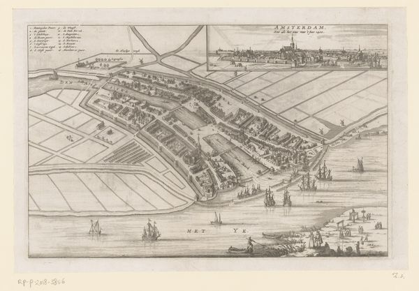
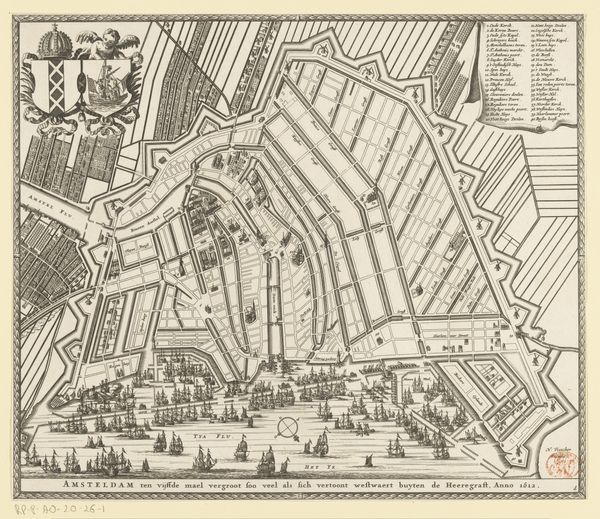
Dimensions: height 260 mm, width 310 mm
Copyright: Rijks Museum: Open Domain
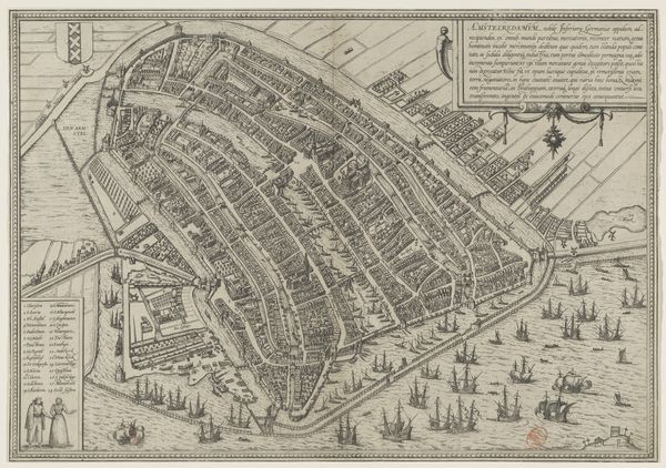
This is an anonymous map of Amsterdam from around 1400, rendered with ink on paper. At first glance, the intricate network of lines defines the city's layout, where the dark, densely packed structures contrast sharply with the open, flowing waterways. This juxtaposition creates a visual tension, evoking a sense of a tightly organized space amidst natural fluidity. The map utilizes a bird's-eye perspective, a structural choice that flattens the urban landscape, presenting a comprehensive yet abstract representation of the city. Each building is meticulously detailed, revealing a formal concern with accuracy and order. Yet, the inclusion of symbolic elements, such as the ships at sea, disrupt this rigid structure, introducing a narrative layer that transcends mere cartography. The overall effect is a destabilization of the conventional map form. It functions not only as a geographical tool but also as a cultural artifact, reflecting the period's understanding of space, power, and representation. This interplay between form and function challenges the viewer to consider the map's role as both an objective record and a subjective interpretation of its world.
Comments
No comments
Be the first to comment and join the conversation on the ultimate creative platform.
More like this