graphic-art, print, engraving
#
graphic-art
#
baroque
#
dutch-golden-age
#
ship
#
mechanical pen drawing
# print
#
pen sketch
#
landscape
#
line
#
engraving
Dimensions: width 2024 mm, height 1096 mm
Copyright: Rijks Museum: Open Domain
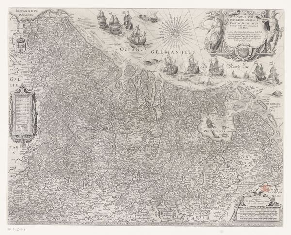
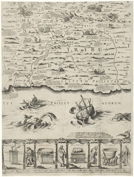
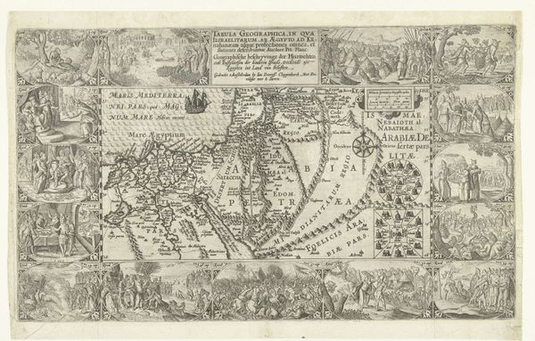
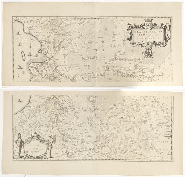
This map of Palestine was created by Nicolaes van Geelkercken, a Dutch cartographer, most likely in the first half of the 17th century. The map reflects the cultural and political interests of the Dutch Republic at the time. In the 17th century, the Dutch Republic was a major center for cartography. Mapmaking wasn't just about geographical accuracy; it was about power, trade, and religious identity. Note the elaborate decorations, biblical scenes, and references to classical antiquity. The mapmakers were keen to assert not just geographical knowledge, but also cultural authority. The inclusion of biblical scenes and references to the "Terra Sancta," or Holy Land, reflects the strong religious sentiments in Dutch society, influenced by the Protestant Reformation. The map served not only as a geographical tool but also as a cultural artifact, reinforcing the Dutch Republic's sense of identity and its relationship to the wider world. To fully understand this map, we can look at historical records, trade documents, and religious texts from the period. This helps us understand how the map reflects the complex social and institutional dynamics of its time.
Comments
No comments
Be the first to comment and join the conversation on the ultimate creative platform.
More like this