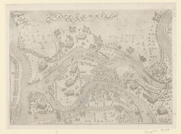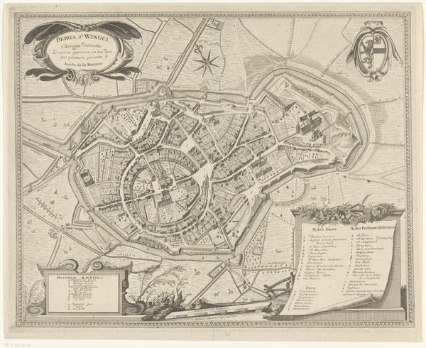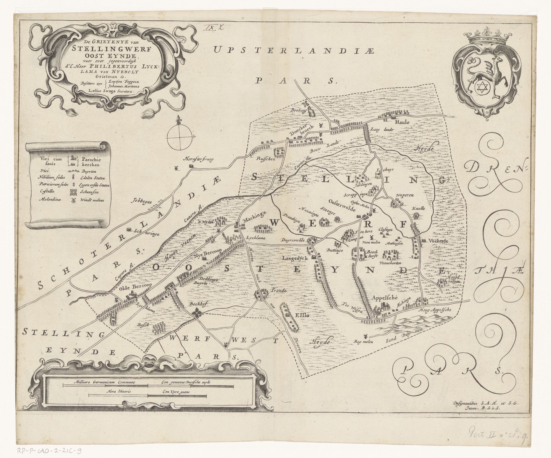
1664
Kaart van de grietenij Ooststellingwerf
Jacob van Meurs
1620 - 1680Location
RijksmuseumListen to curator's interpretation
Curatorial notes
Editor: This is a map titled "Kaart van de grietenij Ooststellingwerf," created in 1664 by Jacob van Meurs. It’s a drawing, a print, done in ink on paper through engraving, and it’s currently at the Rijksmuseum. What initially strikes me is how much this "landscape" looks like a coded language. How do you interpret this work? Curator: It's fascinating how a seemingly objective map like this encodes power structures. Think about it: Who commissions a map, and why? This isn't just about geographical accuracy; it's about claiming territory, asserting control. Van Meurs, in depicting Ooststellingwerf, participated in shaping the region’s identity within the larger Dutch Republic. Consider the narrative being presented – who is included, who is excluded? Editor: That makes me see it in a totally new light. I hadn’t thought about it as a statement. The details – like the placement of different settlements and the way they’re visually represented – now seem deliberate. What does this map tell us about the lives of the people living there at the time? Curator: It offers a glimpse, albeit a selective one. Are the farmers or laborers who worked the land visible in the map itself? Or just the estates of landowners. What were the tensions, the power dynamics at play within this "grietenij?" This map invites us to question whose perspective is being centered and whose is being marginalized. It speaks to enduring questions of land ownership, resource distribution, and representation. Who gets to decide what a place "is?" Editor: So, by looking at the map's choices, its inclusions and omissions, we can start to unpack the social and political landscape of the time. I guess a map is never just a map. Curator: Exactly! It’s a powerful tool of shaping perspectives, and the critical lens through which we examine it today is essential for a fuller, more just, understanding. Thank you.