print, engraving
#
baroque
# print
#
landscape
#
geometric
#
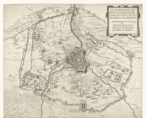
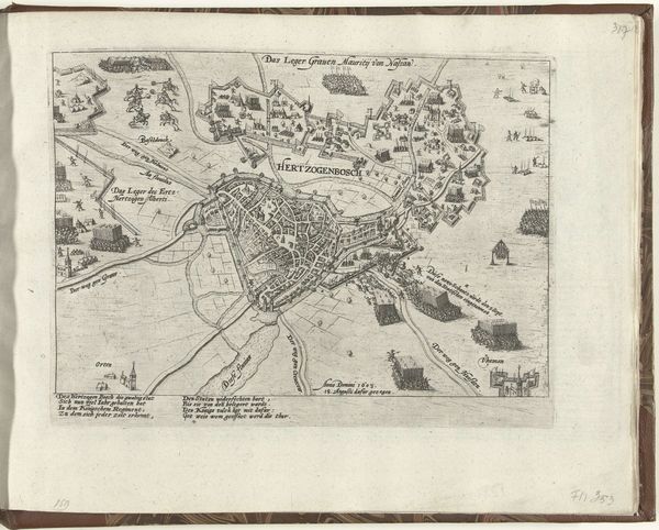
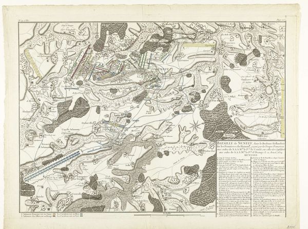
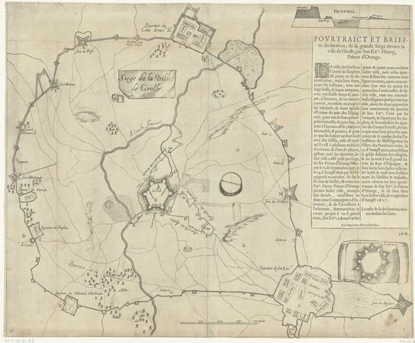
cityscape
#
history-painting
#
engraving
Dimensions: height 320 mm, width 435 mm
Copyright: Rijks Museum: Open Domain
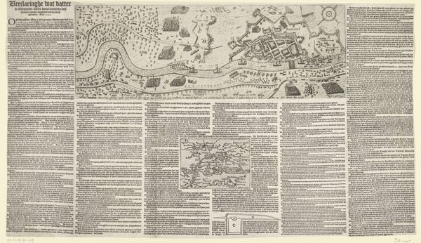
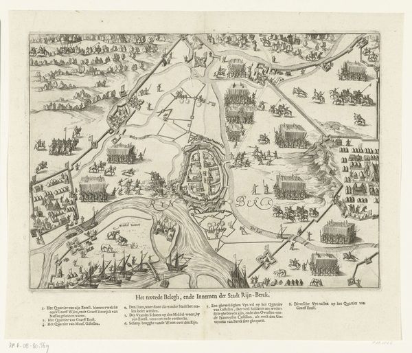
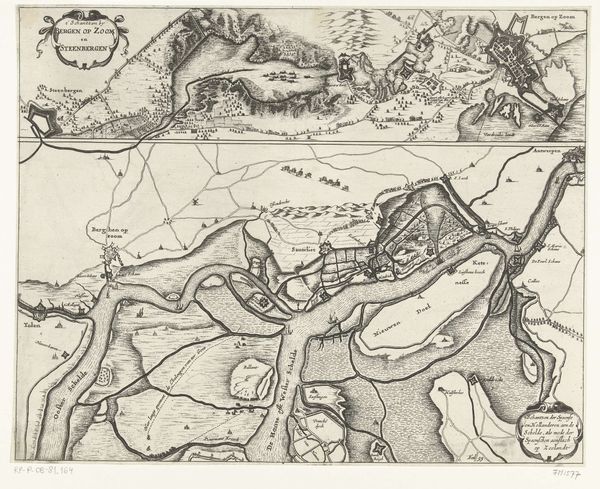
Editor: So, here we have Henri Liebaux's "Kaart van de slag bij Landen, 1693," an engraved print depicting, as the title suggests, a map of the battle. I'm immediately struck by the almost sterile depiction of such a violent event. All those neat little rows of... are those supposed to be soldiers? It's hard to imagine the chaos. How should we interpret this kind of historical visual record? Curator: That "sterility" is precisely the point. This isn’t just a record; it’s a carefully constructed representation of power. What social functions were served by detailing battles like this? Who controlled the dissemination of such images, and what were their objectives? Editor: I see... so, not just about showing what *happened* but about controlling *how* it's perceived. The detailed landscape, the formations… almost like an architect's plan, but for a slaughter. Were these images aimed at the general public? Curator: It's complex. Remember, literacy was limited. These prints would have been displayed and discussed in specific circles - military elites, political figures, those with the power to shape public opinion, or maybe fund future military actions. Does seeing it through that lens change your impression of it? Editor: It does. Knowing who it was *for* makes the abstraction of the battle more… cynical, maybe? Detaching the viewer from the human cost of war. I had naively expected something more dramatic, like a typical history painting. Curator: And there's your clue. Consider the institutions – the military, the monarchy, the printing houses – and how they collaborate to shape our understanding of historical events, even centuries later through museums like ours. Are we complicit by displaying them without critique? Editor: It's definitely food for thought. I originally saw just a historical document but now I see the cultural politics it’s deeply rooted in. Curator: Exactly. Now consider the public role of art like this, and ask yourself: whose narrative are we perpetuating and how can we do it better?
Comments
No comments
Be the first to comment and join the conversation on the ultimate creative platform.
More like this