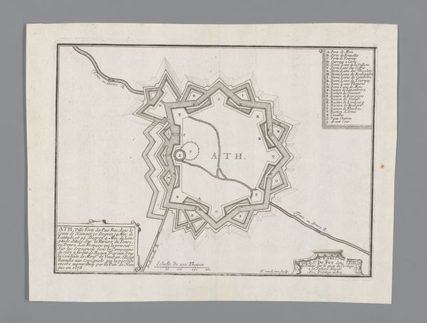
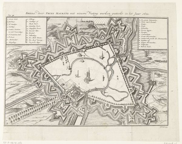
Plattegrond van een deel van de verdedigingswerken van Bergen op Zoom, 1747 1747
0:00
0:00
anonymous
Rijksmuseum
drawing, print, paper, engraving
#
drawing
#
baroque
# print
#
paper
#
geometric
#
line
#
history-painting
#
engraving
Dimensions: height 315 mm, width 477 mm
Copyright: Rijks Museum: Open Domain
Curator: This intriguing schematic is titled "Plattegrond van een deel van de verdedigingswerken van Bergen op Zoom, 1747." It is held at the Rijksmuseum and is thought to be crafted by an anonymous artist, using engraving on paper. Editor: Wow, that is dense. At first glance, it's like a highly ordered, yet slightly menacing labyrinth. Look at all those lines. Curator: It’s definitely a fascinating illustration of power dynamics through urban planning, don't you think? The elaborate defense works reveal the societal anxieties regarding territory and invasion during this period. Consider this map as a lens to examine how space is politicized and gendered. The very act of creating boundaries enforces inclusion and exclusion. Editor: Totally. It's like visualizing paranoia! And I wonder how accurate it really was, this representation of fortifications. Is it a piece of propaganda, projecting strength, or a faithful record? Also, the little notations must’ve taken forever! They really add to this obsessive sense of detail. Curator: The lines certainly contribute to this sense, executed in a baroque style. These architectural forms became expressions of state power. Editor: Do you ever imagine tiny people scurrying through these forts? I see it almost like a giant anthill, an ecosystem designed for defense and dominance, I suppose. It has a strange, quiet beauty, even. Curator: The 'quiet' feeling probably stems from the drawing’s precision. In terms of our current lens, this blueprint showcases the relationship between architecture and governance, revealing biases in both historical narratives and physical infrastructure. Maps are not neutral objects. Editor: Exactly, maps define possibilities but erase others. Overall, I love how something seemingly cold and strategic manages to stir the imagination. It is pretty wild how, with time, it transforms into a historical curiosity that speaks about broader narratives about social change. Curator: Well said. It certainly makes you consider what constitutes safety, for whom, and at what price.
Comments
No comments
Be the first to comment and join the conversation on the ultimate creative platform.
More like this