Dimensions: image: 18.8 x 23.2 cm (7 3/8 x 9 1/8 in.)
Copyright: CC0 1.0
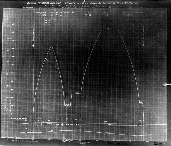
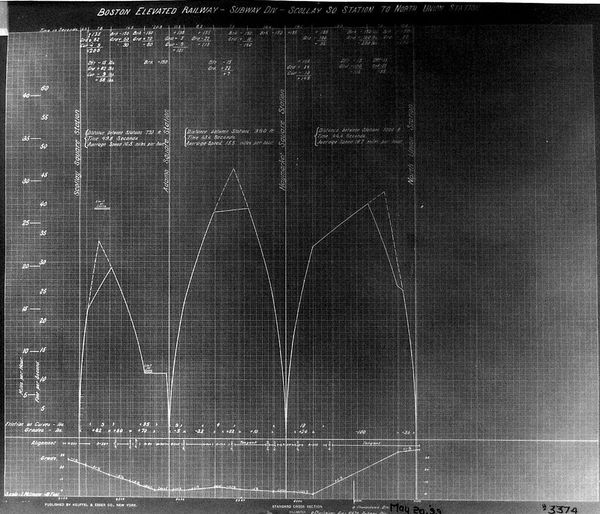
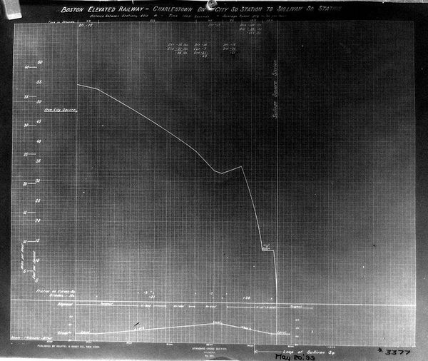
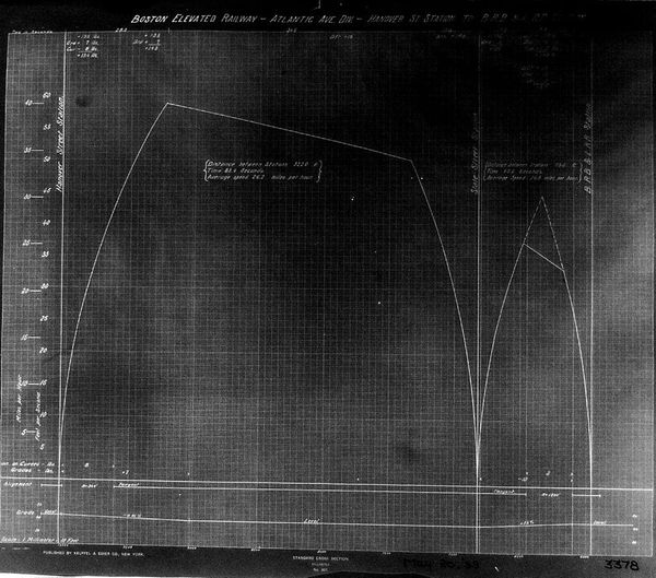
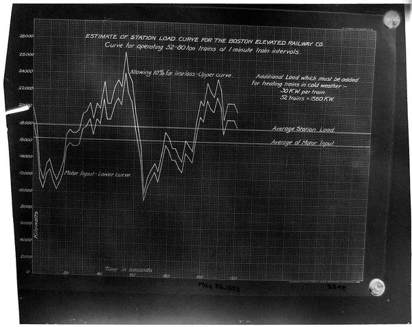
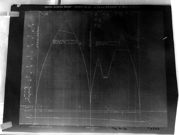
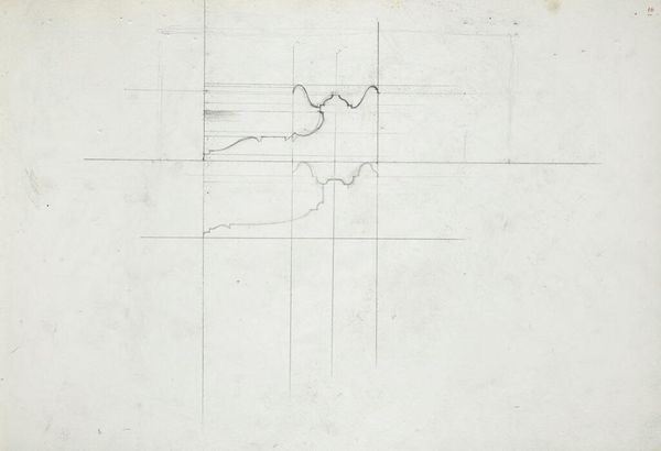
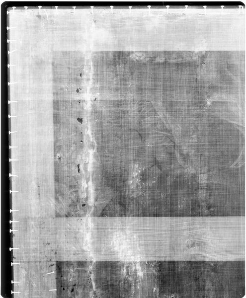
Curator: This is "Chart BERy, Atlantic Ave. Div." by Paul Rowell. The image details an infrastructural elevation plan, currently held at the Harvard Art Museums. It’s… surprisingly elegant, isn’t it? Editor: Hauntingly so. There’s something about the stark lines against the grid that feels both precise and deeply unsettling, a portrait of control and also, perhaps, erasure. What stories are buried beneath the transit lines? Curator: Rowell presents us with something ostensibly functional, but rendered in a way that elevates it. I imagine him hunched over it, almost lovingly mapping the city’s bones. Editor: The graph becomes a visual metaphor for power, access, and segregation. Who benefited from this railway? Who was displaced, and how were communities irrevocably altered? Curator: Maybe it's the lack of human presence, but I can't help but feel a strange nostalgia for this old chart. Editor: It's a beautiful blueprint of urban division, a reminder that progress often comes at a steep social cost. An efficient but indifferent monument.
Comments
No comments
Be the first to comment and join the conversation on the ultimate creative platform.
More like this