print, engraving
dutch-golden-age
landscape
cityscape
history-painting
engraving
Dimensions: height 359 mm, width 475 mm
Copyright: Rijks Museum: Open Domain
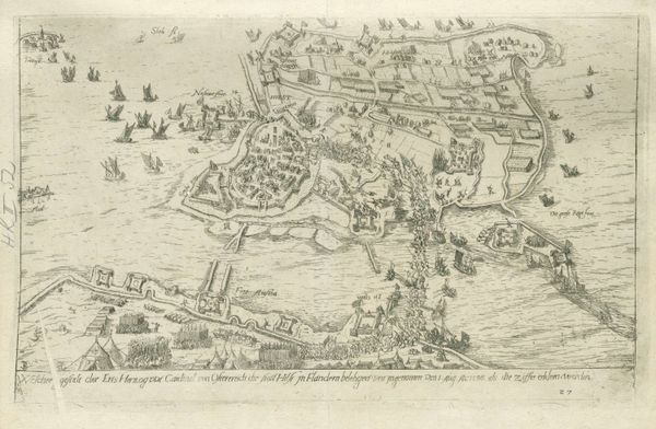
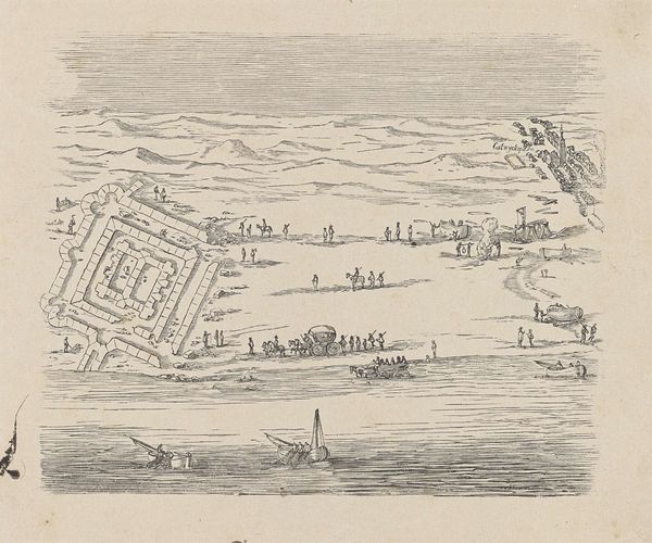
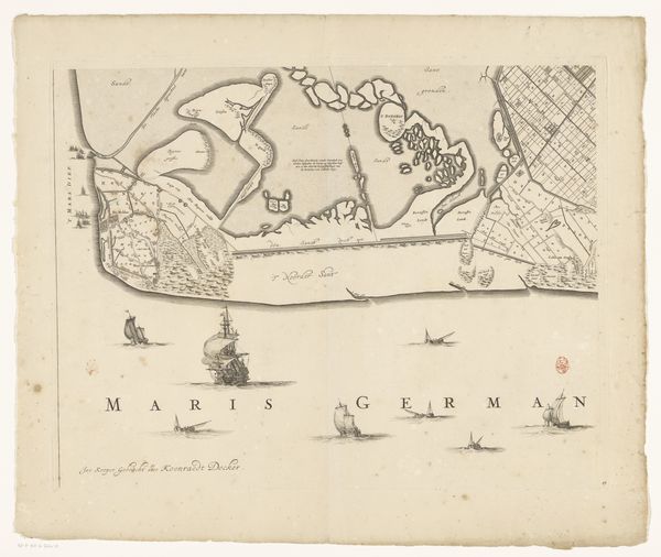
This detailed map of Fort Rammekens was produced by an anonymous artist. It offers a bird's eye view of the fort, situated on the island of Walcheren in Zeeland, likely created during the height of Dutch maritime power. The image creates meaning through its precise rendering of the fort's layout, the surrounding landscape, and the numerous ships in the harbor. Made during a time of intense maritime activity and naval conflict in the Netherlands, the map reflects the strategic importance of the location. Rammekens was the oldest sea fort in Europe and served as a crucial base for the Dutch fleet and the Dutch East India Company. Maps such as this one were essential tools for military planning and navigation, and their production was often supported by state institutions. Understanding the context of this map requires considering the Netherlands’s complex relationship to its surrounding waters and the powerful economic drivers of naval expansion. Historical documents, shipping records, and military archives provide crucial insights into the map's purpose and historical significance.
Comments
No comments
Be the first to comment and join the conversation on the ultimate creative platform.