drawing, print, ink, engraving
drawing
comic strip sketch
dutch-golden-age
mechanical pen drawing
pen sketch
landscape
personal sketchbook
ink
sketchwork
geometric
pen-ink sketch
pen work
sketchbook drawing
cityscape
storyboard and sketchbook work
sketchbook art
engraving
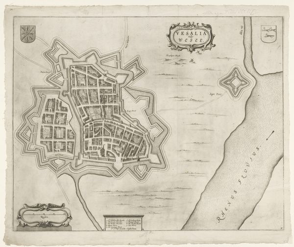
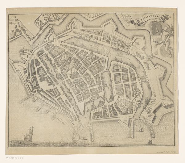
Dimensions: height 414 mm, width 518 mm
Copyright: Rijks Museum: Open Domain
This detailed map of Veere was made by an anonymous maker, using ink on paper. The material itself isn't precious, but the process reveals a lot. Look closely, and you’ll notice the fineness of the lines, all done by hand. The map wasn't just about geographical accuracy; it was also about social control. Notice the regimented layout of the town, the clear demarcation of space, and the ships at sea, implying trade and dominion. Every element speaks to a society structured by power, and the immense amount of labor required reflects the time and importance invested in its production. This wasn't just a practical document; it was a statement. The act of mapping, of defining and recording territory, was deeply intertwined with governance and authority. The map is both art and information, blurring the boundaries between the practical and the aesthetic.
Comments
No comments
Be the first to comment and join the conversation on the ultimate creative platform.