print, engraving
#
baroque
# print
#
landscape
#
cityscape
#
engraving
Dimensions: height 379 mm, width 494 mm
Copyright: Rijks Museum: Open Domain
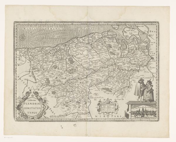
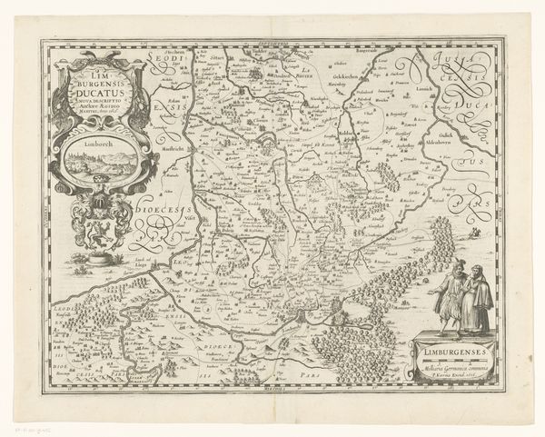
This is an anonymous map of the Duchy of Luxembourg, carefully rendered as an engraving. It reflects a time when cartography was as much about power and identity as it was about geography. Notice how the map meticulously details the landscape. It shows forests, rivers, and settlements. These details would have served a very specific purpose in the assertion of territorial claims. The inclusion of a couple dressed in what looks like aristocratic clothing subtly reinforces a sense of ownership and authority over the land. In this context, think about the map not just as a tool for navigation, but as a statement of cultural and political identity. Who is allowed to be represented in the space of Luxembourg? How are they represented? Consider the emotional weight carried by such representations. For those living within the depicted territory, this map would have instilled a sense of belonging and pride, but for outsiders, it may have served as a clear message of exclusion.
Comments
No comments
Be the first to comment and join the conversation on the ultimate creative platform.
More like this