graphic-art, print, engraving
#
graphic-art
# print
#
cityscape
#
history-painting
#
decorative-art
#
engraving
Dimensions: height 233 mm, width 277 mm
Copyright: Rijks Museum: Open Domain
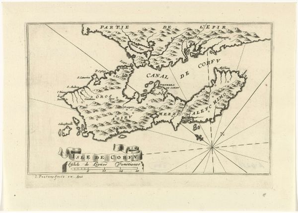
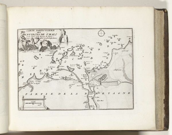
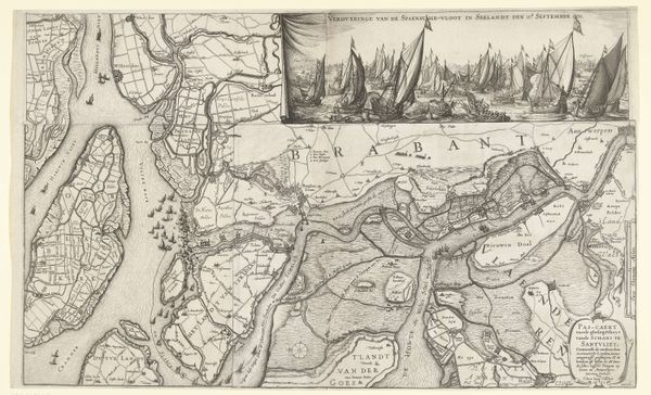
This map of Vigo was created by Abraham Allard around the late 17th or early 18th century. The stark, almost clinical linework immediately establishes a sense of precision, yet the texture of the paper hints at the human hand behind its creation. The composition is carefully structured, balancing the sprawl of the coastline with the neat, informative text. The map's function is clear: to represent space, but it does so through a formal language of lines and labels. We can interpret the varying line weights as a visual hierarchy, differentiating between land, sea, and administrative divisions. This structured approach reveals the influence of Enlightenment ideals, where order and reason were paramount in understanding and representing the world. The map isn't just a depiction of Vigo; it’s an assertion of control over territory, a semiotic declaration of power through spatial representation. Notice how Allard uses a muted palette, allowing the form and structure of the map to take precedence. This isn't just about geographical accuracy; it's about constructing a visual language that reflects a specific worldview. It's a system that encourages us to question how we perceive and engage with the spaces around us.
Comments
No comments
Be the first to comment and join the conversation on the ultimate creative platform.
More like this