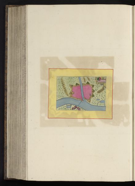
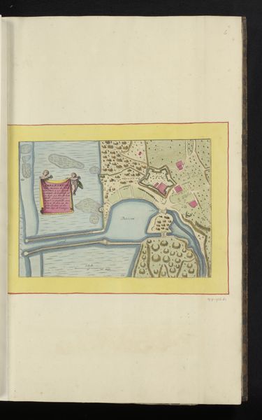
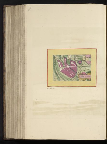
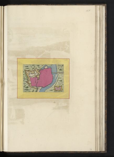
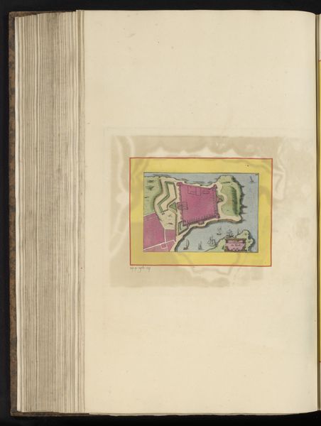
Plattegrond van de ligging van het kasteel van Pont-de-l'Arche ten opzicht van de stad 1657
0:00
0:00
drawing, paper, watercolor
#
drawing
#
aged paper
#
toned paper
#
homemade paper
#
sketch book
#
landscape
#
paper
#
personal sketchbook
#
watercolor
#
coloured pencil
#
sketchbook drawing
#
watercolour illustration
#
sketchbook art
#
watercolor
Dimensions: height 252 mm, width 163 mm, height 532 mm, width 318 mm
Copyright: Rijks Museum: Open Domain
Curator: Looking at this piece, I immediately get a feeling of strategic tension. It’s fascinating how cartography can convey so much more than just location. Editor: Absolutely. Let’s dive into it. What we have here is an anonymous 17th-century drawing, “Plattegrond van de ligging van het kasteel van Pont-de-l'Arche ten opzicht van de stad,” or, "Plan of the location of the castle of Pont-de-l'Arche in relation to the city," created around 1657 using watercolor and colored pencil on paper. It’s a bird’s-eye view. Curator: That castle practically leaps off the page! Note how the artist uses vibrant hues to delineate the castle walls from the surrounding land. What might that signify? I wonder how color helps us understand which part of the city was deemed significant? Editor: Good question. Pont-de-l'Arche held substantial political sway during this period, and, thus, was highly strategic. I imagine that maps like this helped leaders visualize their defenses and how power was structured across the territory. Consider how city planning and cartography played a significant role in expressing authority at that time. Curator: Indeed. Symbols are vital in conveying a worldview. Water is the calm, connecting agent. But what's truly fascinating is that symbolic relationship between the physical land, as represented through the river, and strategic structures – I imagine that river represents not just transport and logistics but perhaps the lifeblood of the city itself? The city quite literally orbits it. Editor: I think you’re right about the lifeblood metaphor. But more pragmatically, notice where the artist’s compass rose points. Given the lack of roads in that period, one could assume the rose, and the text at the bottom, probably help contextualize what can and cannot be reached. Curator: What really gets my attention is the tension. I notice an imbalance. I would read into that imbalance a potential for weakness – or even conflict! I bet there's something hidden here about this power dynamic – a castle, a bridge: the image seems loaded with social and psychological undercurrents that ripple out across this community. Editor: These maps help us grasp the tangible infrastructure that structured governance at the time, illustrating not just the physical landscape, but the mechanisms of social and political life in the 17th century. This artwork illustrates our modern challenge: what is lost as technology flattens symbolic tension and expression? Curator: This isn't just a map. This drawing gives us a glimpse into the heart of a city, revealing both its external defenses and inner character. Thank you.
Comments
No comments
Be the first to comment and join the conversation on the ultimate creative platform.
More like this