drawing, print, paper, ink
#
drawing
#
baroque
# print
#
paper
#
ink
#
geometric
#
cityscape
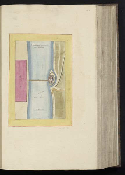
Dimensions: height 104 mm, width 152 mm, height 532 mm, width 320 mm
Copyright: Rijks Museum: Open Domain
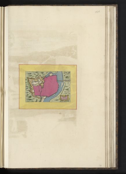
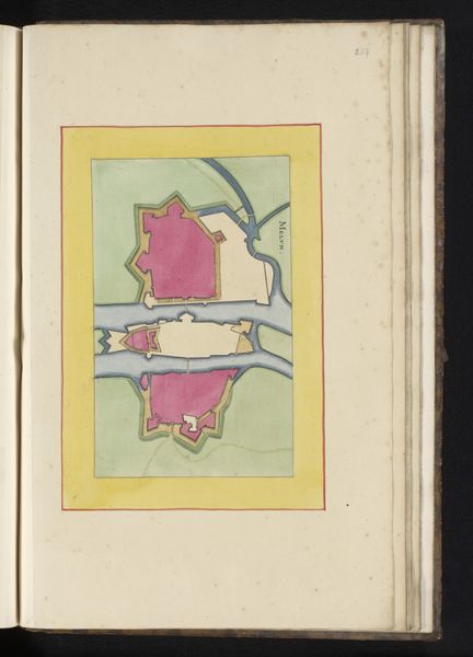
Editor: Here we have a print from 1638, "Plattegrond van het kasteel van Brest," an anonymous work made with ink on paper. It's striking how geometric everything is, almost like a child's drawing of a fort. What jumps out at you? Curator: The geometric precision, as you noted, isn’t just aesthetic. It speaks to a specific need. Can you guess what? Editor: Mapping or planning, maybe? For building? Curator: Precisely. Notice the fort's placement near the water; it recalls not just geographical location but a specific kind of defense – that’s part of its visual language. Brest, even in symbolic form, held significance. What might that have been, do you think, given it's rendered with such attention to detail? Editor: I'd guess strategic importance, being near the sea. Like they needed it for trade, and wanted to mark its location. Curator: Absolutely. Consider how such depictions fostered a sense of identity, of knowing one's territory. It’s like a form of visual claiming, deeply tied to place and power. What remains, then, is not merely the aesthetic blueprint, but a piece pregnant with the cultural weight of its time. Editor: That connection between the symbolic and the strategic hadn't occurred to me so clearly. It makes you consider the multiple layers any image might carry. Curator: Indeed. And in turn it influences what meaning we project into it.
Comments
No comments
Be the first to comment and join the conversation on the ultimate creative platform.
More like this