drawing, paper, ink
#
drawing
#
landscape
#
paper
#
ink
#
geometric
#
cityscape
Dimensions: height 103 mm, width 151 mm, height 532 mm, width 320 mm
Copyright: Rijks Museum: Open Domain
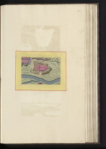
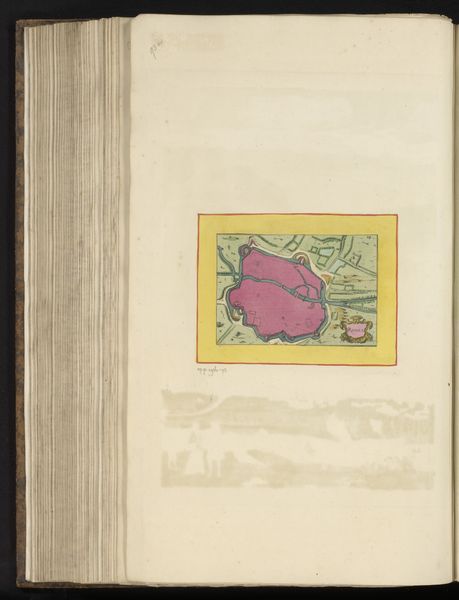
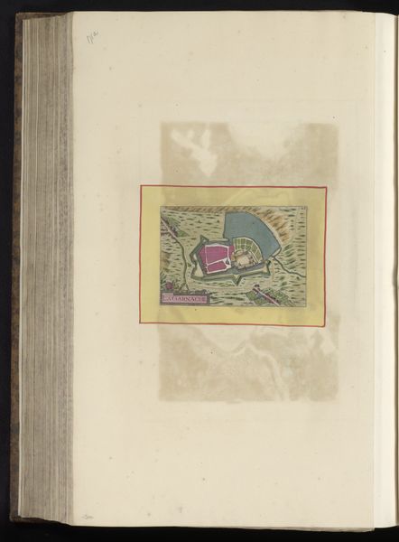
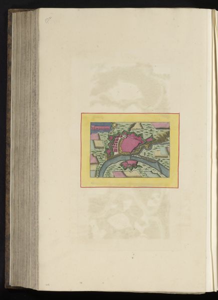
Curator: Immediately striking, isn’t it? This is "Vestingplattegrond van Bayonne," a 1638 drawing, skillfully rendered in ink on paper by an anonymous artist. What impressions does it spark for you? Editor: At first glance, I see a stylized blend of vulnerability and dominance. That vibrant pink fort, intersected by the river—it projects a confident power, yet the deliberate openness feels like a challenge or perhaps an invitation. The pink city is unusual. Curator: The unusual color points towards the complexities of siege warfare and urban power in the 17th century. We must see how cities controlled crucial economic assets through strategic military deployment in public imagination. This "Vestingplattegrond," as a formal artistic creation, served strategic communication purposes. Editor: The geometric organization underscores your points perfectly. The artist created a lasting symbol of steadfastness. Those careful lines, the unwavering river, the almost toy-like presentation – each plays into this cultural idea of control. And the contrast of this highly structured inner space against the suggested organic world beyond the boundary has so much emotional and conceptual depth. Curator: Yes, its cultural symbolism runs far deeper than a simple representation. While these plans served military intention, as tools for city defense and attack planning, the maps served state interest by presenting these complex socio-spatial realities with symbolic visual authority, as well as a visual narrative of power and state building. Editor: I keep thinking about that unexpected choice of pink for the fort's outline, an odd symbol choice in our culture that does a great job pulling people into the image. Curator: The symbolism in these city plans, often overlooked, reflect societal ambition. Bayonne, poised at that vital location in southwest France, had great strategic weight. Editor: Ultimately, I look at this image and appreciate its place at an important, physical moment of strategic symbolism, showing us something both concrete and full of ideas. Curator: Indeed, considering both its historical context and immediate imagery certainly enhances how we connect to "Vestingplattegrond van Bayonne".
Comments
No comments
Be the first to comment and join the conversation on the ultimate creative platform.
More like this