drawing, print, ink, engraving
#
drawing
# print
#
pen illustration
#
ink
#
cityscape
#
history-painting
#
engraving
Dimensions: height 222 mm, width 316 mm
Copyright: Rijks Museum: Open Domain
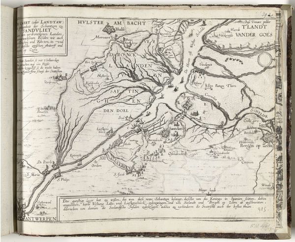
This map of Havana and its bay on Cuba was created around 1702 by an anonymous artist. It’s made through engraving, a printmaking technique using a metal plate. The process begins with a polished copper or zinc plate. The design is then carefully incised with a tool called a burin, creating grooves that hold ink. The plate is then inked, and the surface wiped clean, leaving ink only in the incised lines. Damp paper is laid on the plate, and both are run through a high-pressure press. The pressure forces the paper into the inked grooves, transferring the image. The final print is a mirror image of the original design. The crisp lines and fine details of the map speak to the engraver’s skill. Each tiny mark represents a deliberate action, a transfer of knowledge and power. Maps like this weren't just about geography; they were tools of colonialism, defining territories and asserting control. Understanding the physical making of this map helps us understand its social and political context.
Comments
No comments
Be the first to comment and join the conversation on the ultimate creative platform.
More like this