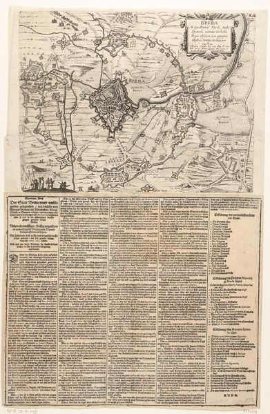
print, etching, engraving
#
baroque
# print
#
etching
#
landscape
#
line
#
history-painting
#
engraving
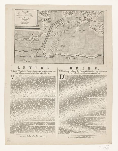
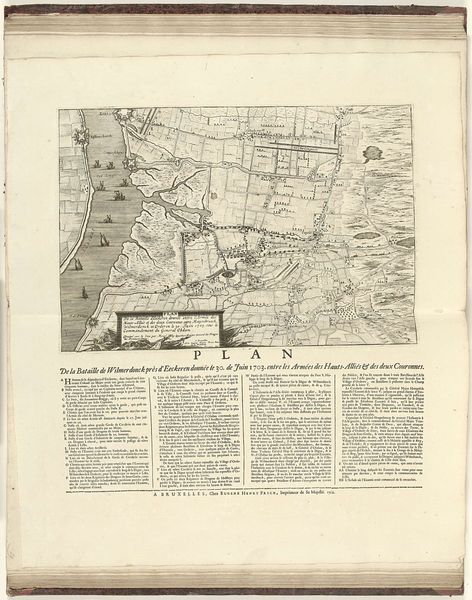
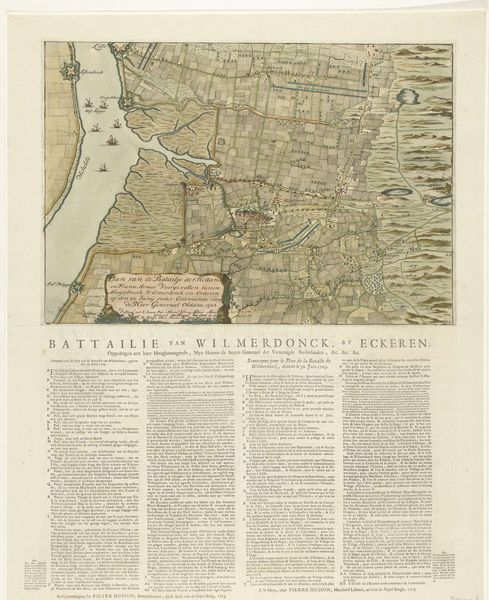
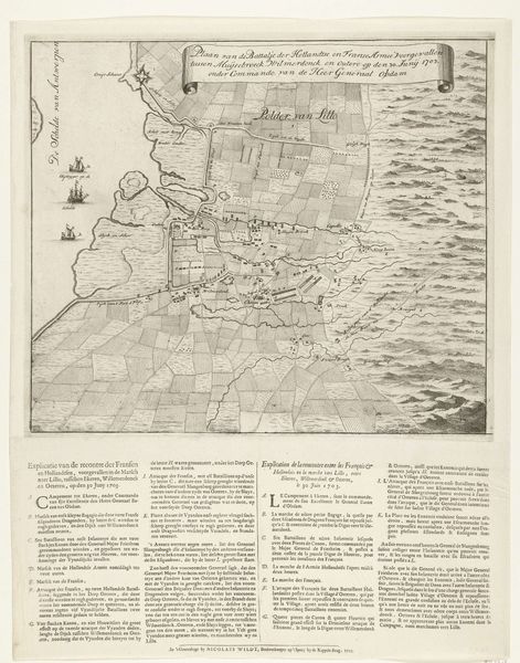
Dimensions: height 635 mm, width 483 mm
Copyright: Rijks Museum: Open Domain
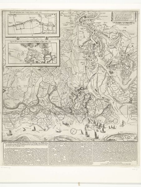
Curator: This etching, created in 1703, is titled "Kaart van de veldslag bij Ekeren", or "Map of the Battle of Ekeren," and it’s housed at the Rijksmuseum. What strikes you first about it? Editor: Immediately, I’m drawn to the dense, almost suffocating quality of the etched lines. It’s a battle map, yet there’s this sense of enclosure and constriction that speaks to the brutal reality of warfare and territorial disputes that dominated the era. Curator: Indeed. Consider the processes involved: the labor of the engraver, meticulously transferring the cartographer's design onto the copperplate. Look at the detail: the deliberate choices about which landmarks to include and how the typography and text adds informational layering about military engagements, movements, and positions. It shows not just place, but planning and production as tools of empire. Editor: And notice the broader socio-political context. This isn't merely an objective depiction of terrain. It’s a carefully constructed narrative legitimizing Dutch power, erasing indigenous narratives and justifying military incursions. What’s presented as a simple battlefield is deeply implicated in systemic inequalities. Curator: Right. We can read this as a commodity, bought and sold. The paper, ink, the engraving tools, the skill of the artisans... These elements were all part of an emerging capitalist system fueling these military campaigns and solidifying certain power structures. How does this kind of print-making reflect both craftsmanship and capitalist enterprise? Editor: Precisely. Think about how these images shape collective memory and cultural identity, solidifying the victor's perspective and potentially silencing dissenting voices. Also consider the implications around access to cartographic information as a form of political control in itself. Curator: Ultimately, approaching this image requires us to interrogate how meaning is constructed, distributed, and consumed within a specific socio-economic context. How did the material circumstances shape its creation and its lasting impact? Editor: It's an important question. Reflecting on these factors makes one wonder about how this map participated in shaping the understanding of war, territory, and belonging. By exposing these historical and societal contexts, we make it a much richer conversation about power, identity and representation.
Comments
No comments
Be the first to comment and join the conversation on the ultimate creative platform.
More like this