print, engraving
#
baroque
# print
#
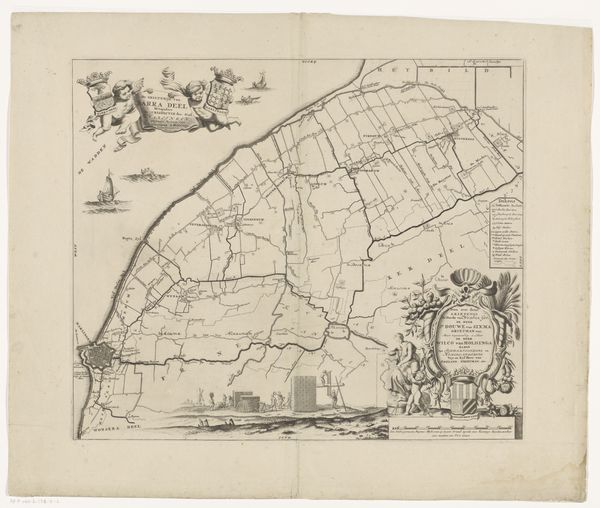
landscape
#
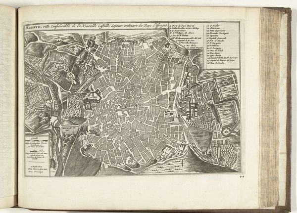
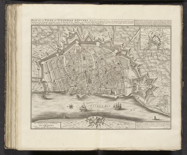
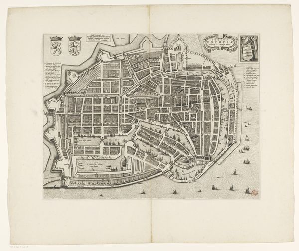
cityscape
#
history-painting
#
engraving
Dimensions: height 610 mm, width 472 mm
Copyright: Rijks Museum: Open Domain
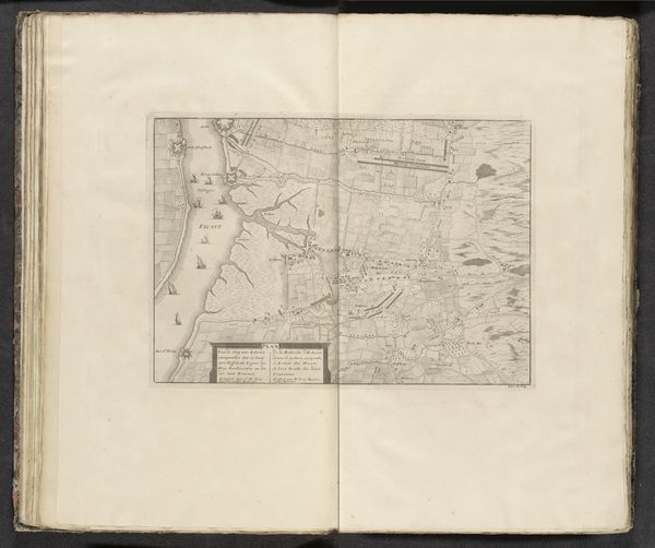
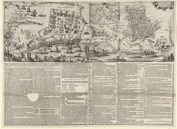
This detailed map of the Battle of Ekeren was etched by Jacobus Harrewijn in 1703. The visual language of cartography, with its symbols for terrain, structures, and military positions, provides a structured narrative of conflict. Consider how the ordering of space is employed to exert control over events. Maps are a recurring motif through human history. From ancient Roman cadastral surveys to contemporary satellite images, the desire to chart, survey, and command territory through visual representation persists. The act of mapping has never been a neutral one. It has always carried political and psychological weight. The power dynamics of claiming and organizing space has been repeated across civilizations and eras. The precision of these lines and symbols gives a sense of mastery and the ability to impose order on chaos. The map becomes a potent symbol not just of physical space, but of human ambition and the enduring quest to understand and dominate our surroundings.
Comments
No comments
Be the first to comment and join the conversation on the ultimate creative platform.
More like this