drawing, print, paper, ink
#
drawing
#
dutch-golden-age
# print
#
landscape
#
paper
#
ink
#
coloured pencil
#
history-painting
#
watercolor
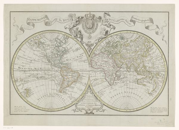
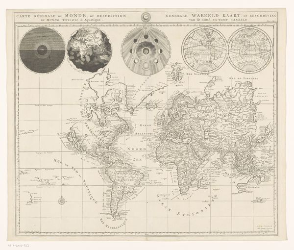
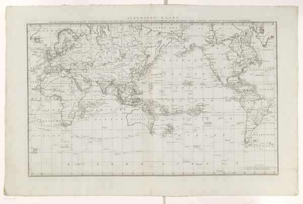
Dimensions: height 400 mm, width 477 mm
Copyright: Rijks Museum: Open Domain
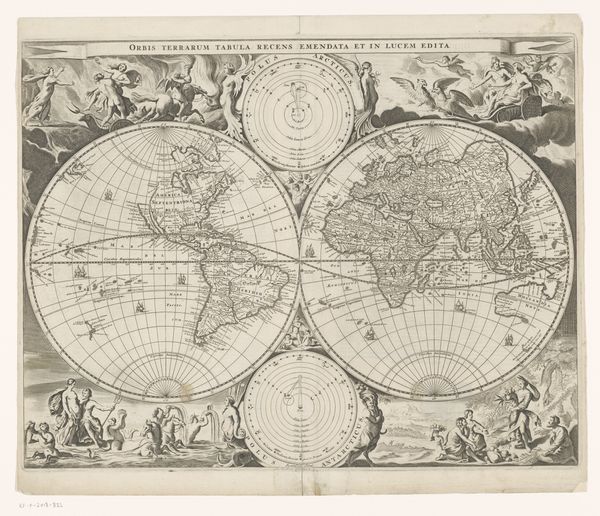
Curator: This is "Wereldkaart," or World Map, made around 1700 by Dirk Janszoon van Santen, a print on paper with ink and watercolor. What strikes you about this particular work? Editor: Well, first off, it's beautiful. It is clearly a blend of art and science; the geography itself is visually striking. But it's more than just accurate representation, it’s quite decorative with the other diagrams. How do you interpret this intersection? Curator: The key to understanding this work lies in recognizing the dialectic between representation and abstraction. Consider how the central map presents a detailed, albeit slightly distorted by modern standards, view of the continents. Note the use of line and color to delineate territories. Then examine the supplementary diagrams. How do they function within the overall composition? Editor: I see that they add other forms of information like some kind of astrological data. Are you suggesting this is intended to be seen less as a source of geographic facts, and more as a statement of 18th century worldview? Curator: Precisely. The placement, size, and coloration of these supplementary images create a visual hierarchy. The artist employs this structure to subtly assert a particular worldview, not just as an informative piece of art. What, then, does the emphasis on certain visual elements convey about the culture from which this map originated? Editor: So, it's less about what the map shows, and more about how the different elements are composed and colored, working together to form a message about the culture it represents. I see that, that's insightful. Thank you. Curator: A formalist reading provides a new framework through which to interpret images we often assume to have a primarily utilitarian function. I am glad I could contribute to your comprehension.
Comments
No comments
Be the first to comment and join the conversation on the ultimate creative platform.
More like this