About this artwork
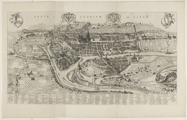
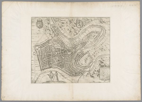
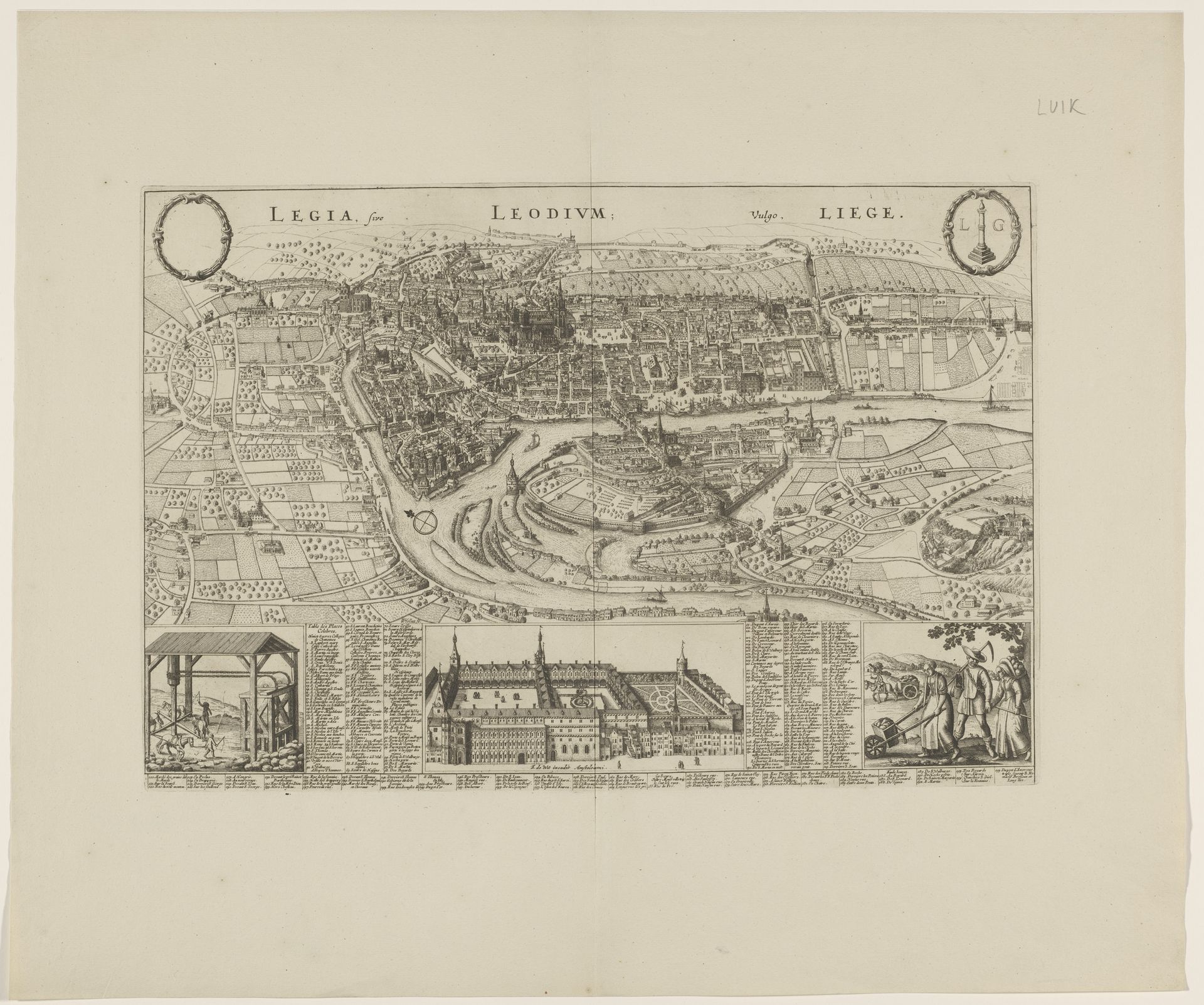
Wenceslaus Hollar created this detailed etching titled "Plattegrond van Luik," capturing the city of Liège with remarkable precision. Hollar, born in Prague, lived through the tumultuous Thirty Years' War, which deeply impacted his life and work. This map is more than a geographical representation; it is a reflection of power, commerce, and identity in the 17th century. Note the way Hollar meticulously depicts the city's fortifications and key buildings. The city's layout emphasizes the strategic importance of Liège, a melting pot of various European powers and interests. The detailed rendering of industries alongside domestic life highlights a stratified society. Hollar’s personal experiences as a refugee likely shaped his understanding of place and belonging, adding a layer of depth to his cartographic work. As you observe this image, consider how maps not only represent space but also embody the complex social, political, and personal narratives of their time.
Artwork details
- Medium
- print, etching
- Dimensions
- height 328 mm, width 485 mm
- Location
- Rijksmuseum
- Copyright
- Rijks Museum: Open Domain
Tags
Comments
Share your thoughts
About this artwork
Wenceslaus Hollar created this detailed etching titled "Plattegrond van Luik," capturing the city of Liège with remarkable precision. Hollar, born in Prague, lived through the tumultuous Thirty Years' War, which deeply impacted his life and work. This map is more than a geographical representation; it is a reflection of power, commerce, and identity in the 17th century. Note the way Hollar meticulously depicts the city's fortifications and key buildings. The city's layout emphasizes the strategic importance of Liège, a melting pot of various European powers and interests. The detailed rendering of industries alongside domestic life highlights a stratified society. Hollar’s personal experiences as a refugee likely shaped his understanding of place and belonging, adding a layer of depth to his cartographic work. As you observe this image, consider how maps not only represent space but also embody the complex social, political, and personal narratives of their time.
Comments
Share your thoughts