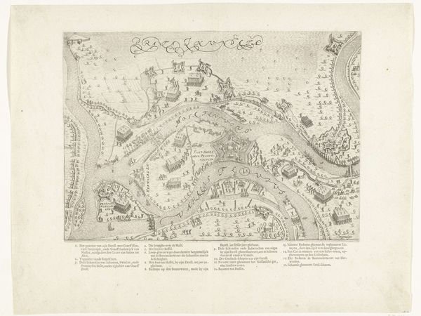
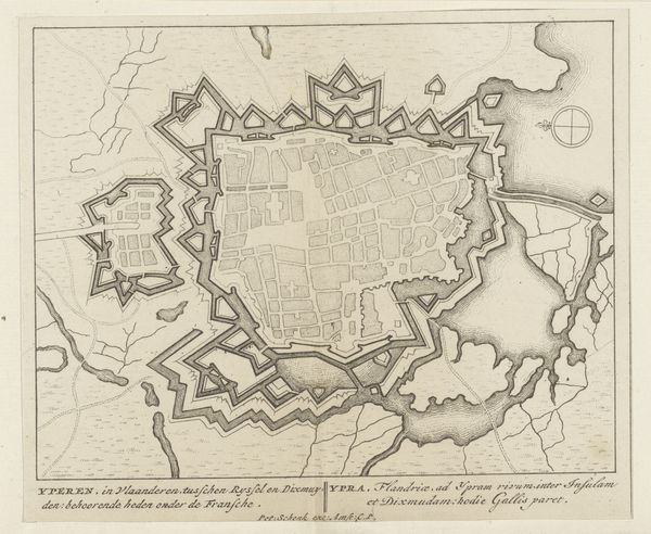
print, engraving
#
baroque
# print
#
landscape
#
geometric
#
cityscape
#
engraving
Dimensions: height 596 mm, width 595 mm
Copyright: Rijks Museum: Open Domain
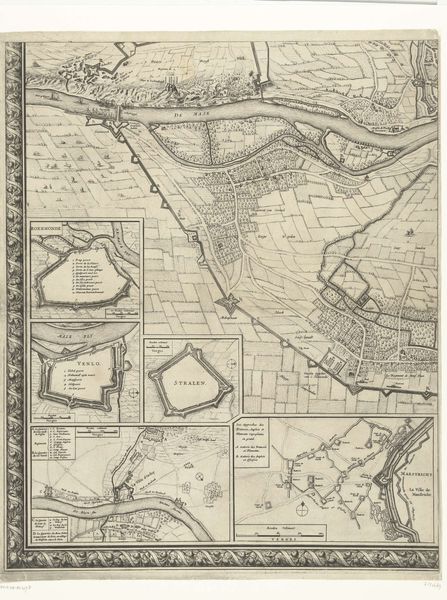
Editor: Here we have "Vestingplattegrond van Namen," a print by Joachim Ottens, dating sometime between 1698 and 1728. Looking at this baroque city plan, I'm struck by how meticulously everything is laid out – the geometry of the fortifications, the way the landscape is incorporated… It's strangely beautiful, in a way that only something designed for war could be. What do you see in this piece? Curator: Oh, this is like finding a beautiful melody hidden in a military march, isn't it? Maps of this period were not just utilitarian; they were statements of power, knowledge, and artistry. Imagine the engraver, hunched over their tools, meticulously translating the world into these crisp, unwavering lines. Each line, each angle whispers a story of control and strategic planning. Editor: So it’s about the *representation* of control, not just the map itself? Curator: Precisely! Think about the sharp, angular shapes of the fortifications contrasting with the more organic lines representing the natural landscape. That juxtaposition highlights the ambition to impose order, human order, onto the unpredictable flux of nature. Do you feel the tension in that contrast? Editor: I do now, actually. It’s like a very organized, controlled intrusion. Before, I was just appreciating the detail, but seeing it as a power play makes it much more… sinister, almost. Curator: "Sinister" is a strong word, but fitting perhaps. And maps, particularly back then, weren't passively documenting the world as much as staking claims upon it. They embody not just geography but intention, aspiration… dare I say, dreams. Editor: This has completely changed how I see this piece. I’m much more attuned to its layers of meaning, and how the visual language reveals a worldview. Curator: Exactly. It is always exciting to get a fresh insight to something old. Maps can be true treasure troves.
Comments
No comments
Be the first to comment and join the conversation on the ultimate creative platform.
More like this