About this artwork
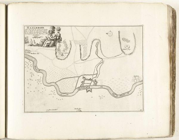
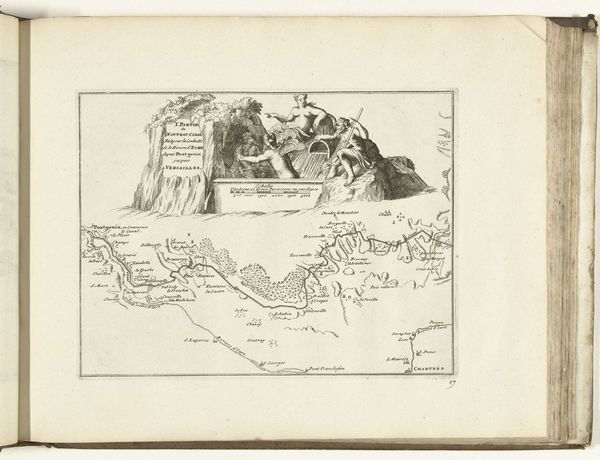
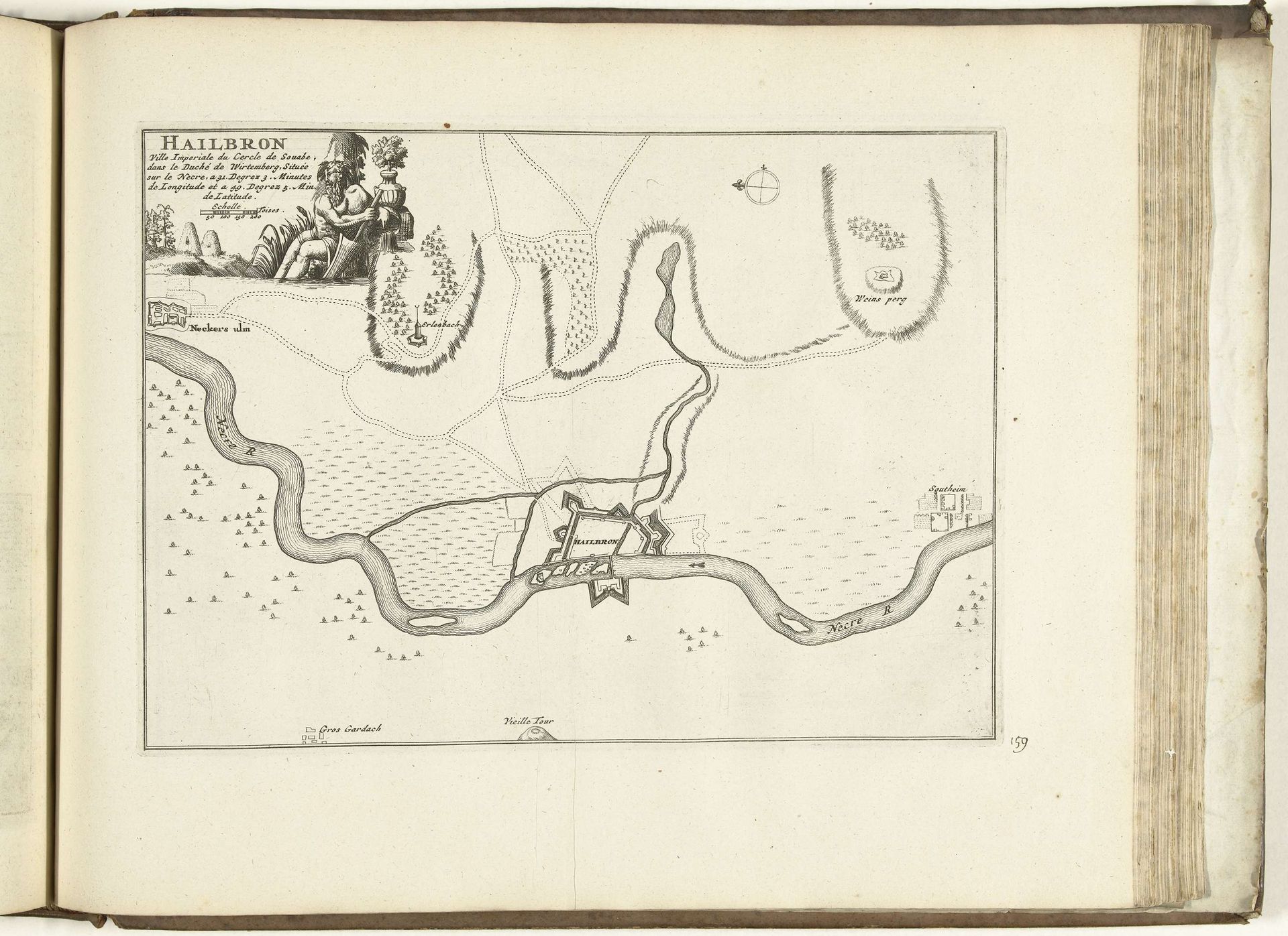
This is an anonymous 'Plattegrond van Heilbronn' from 1726, now held at the Rijksmuseum, made with etching on paper. Created during an era of territorial disputes and burgeoning cartography, this map transcends mere geography, as it embodies the complex relationship between power, identity, and representation. The map gives a bird’s eye view of the city of Heilbronn, but it's the allegorical figures that arrest my attention, positioned as witnesses to the landscape below. Who were these figures meant to represent? Their presence invites us to consider the cultural biases inherent in such representations. Maps are not neutral; they are imbued with the perspectives and intentions of their creators. This particular map serves as both a tool for navigation and a declaration of territorial control. It prompts us to reflect on how maps, throughout history, have been used to define, claim, and often erase identities. As we gaze upon this artifact, let us contemplate the stories it tells and the silences it holds.
Artwork details
- Medium
- drawing, print, paper, ink, engraving
- Dimensions
- height 210 mm, width 291 mm
- Location
- Rijksmuseum
- Copyright
- Rijks Museum: Open Domain
Tags
drawing
baroque
landscape
paper
ink
geometric
cityscape
engraving
Comments
Be the first to share your thoughts about this work.
About this artwork
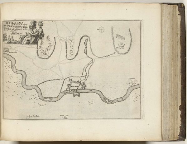
This is an anonymous 'Plattegrond van Heilbronn' from 1726, now held at the Rijksmuseum, made with etching on paper. Created during an era of territorial disputes and burgeoning cartography, this map transcends mere geography, as it embodies the complex relationship between power, identity, and representation. The map gives a bird’s eye view of the city of Heilbronn, but it's the allegorical figures that arrest my attention, positioned as witnesses to the landscape below. Who were these figures meant to represent? Their presence invites us to consider the cultural biases inherent in such representations. Maps are not neutral; they are imbued with the perspectives and intentions of their creators. This particular map serves as both a tool for navigation and a declaration of territorial control. It prompts us to reflect on how maps, throughout history, have been used to define, claim, and often erase identities. As we gaze upon this artifact, let us contemplate the stories it tells and the silences it holds.
Comments
Be the first to share your thoughts about this work.