print, etching, engraving
#
baroque
#
dutch-golden-age
# print
#
etching
#
old engraving style
#
landscape
#
etching
#
engraving
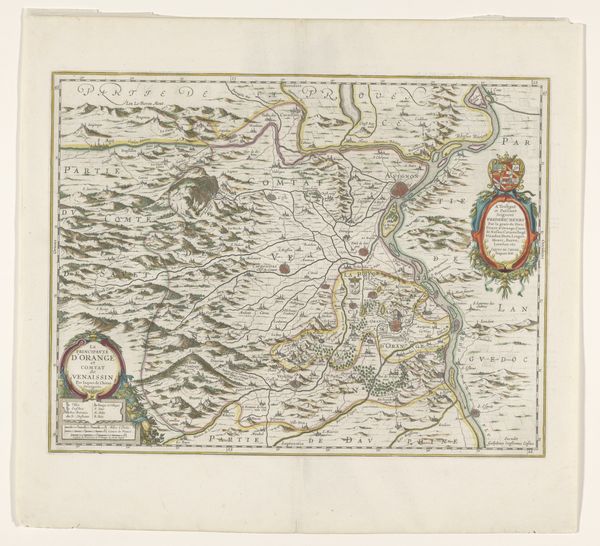
Dimensions: height 563 mm, width 430 mm
Copyright: Rijks Museum: Open Domain
This map of Overijssel, made by François Caumartin, presents a detailed geographical landscape, adorned with symbolic cartouches. The figures atop the title cartouche, reminiscent of classical deities, hold symbolic power over the land. These figures are not merely decorative; they evoke a lineage of ancient gods overseeing territories, much like Roman deities watching over their provinces. Consider how such figures reappear in Renaissance frontispieces, embodying civic virtues and governance. The act of placing such figures atop a map connects the territory to the weight of history and tradition. The map itself, with its rendering of cities, rivers, and borders, reflects a desire to define and control space. There's a psychoanalytic dimension here, too. The very act of mapping can be seen as a projection of the human need to order the chaotic world, a way to assert control over the unknown. These symbols—divine figures, cartouches, the meticulously drawn borders—represent a cycle of human attempts to understand and dominate their environment, surfacing again and again across the ages.
Comments
No comments
Be the first to comment and join the conversation on the ultimate creative platform.
More like this