drawing, print, ink, pen, engraving
drawing
baroque
pen sketch
landscape
ink
pen
history-painting
engraving
Dimensions: height 243 mm, width 351 mm
Copyright: Rijks Museum: Open Domain
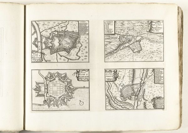
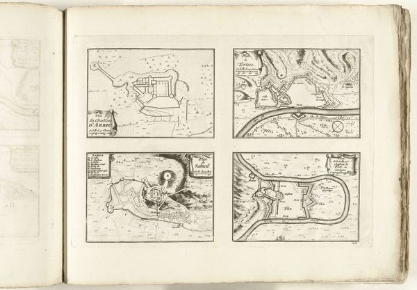
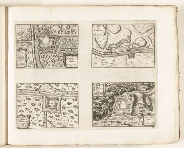
This page of maps, depicting Fort Louis, Trier, Biche, and Homburg, was made around 1702 by an anonymous artist. It's an example of etching, a printmaking technique that relies on acid to 'bite' into a metal plate, in this case probably copper, leaving behind an image that can then be inked and printed. The magic of etching lies in its capacity to capture incredibly fine detail. Notice how the etcher has rendered the fortifications, landscapes, and even the texture of the paper itself. This precision wasn't just for aesthetic appeal; accurate maps were crucial for military strategy and asserting territorial control. The tools for creating these kinds of maps were often as precise and specialized as the weapons used in battle. Think about the social context of these maps, too. They represent a world of constant power struggles and shifting borders, where information was a valuable commodity. The act of etching, with its blend of technical skill and artistic vision, became a tool for shaping that world, defining territories, and projecting authority. It blurs the line between art and document, forcing us to consider the power dynamics embedded within even the most seemingly objective representations of space.
Comments
No comments
Be the first to comment and join the conversation on the ultimate creative platform.