drawing, print, etching, paper, ink
#
drawing
# print
#
etching
#
asian-art
#
landscape
#
paper
#
ink
#
geometric
#
cityscape
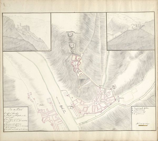
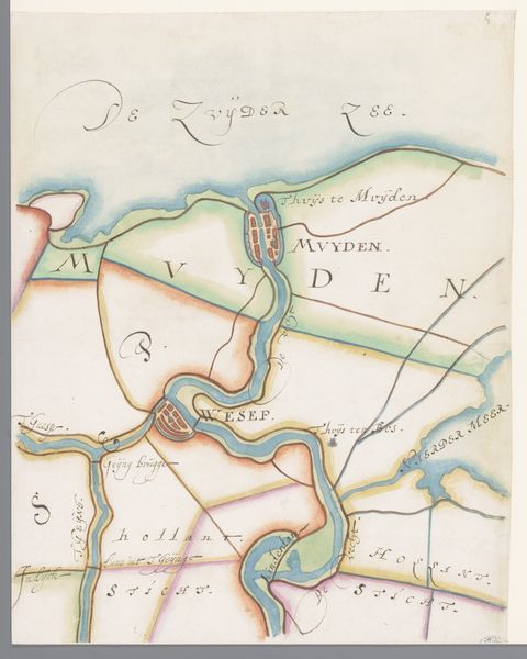
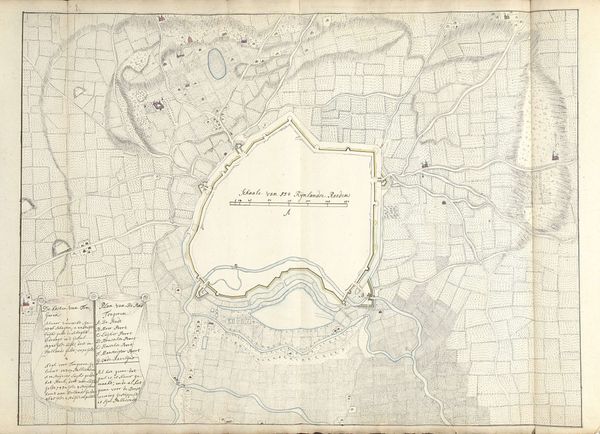
Dimensions: height 425 mm, width 261 mm
Copyright: Rijks Museum: Open Domain
Curator: Before us we have a fascinating piece from 1821, "Kaart van de rivier bij Palembang," or "Map of the River near Palembang." It’s currently held in the Rijksmuseum, crafted anonymously using drawing, etching, and ink on paper. Editor: My initial impression is how strategic it feels. The line work is meticulous, precise, yet simultaneously the washed-out color palette evokes a feeling of impermanence, of colonial ambition perhaps not entirely rooted. Curator: It's intriguing to consider the purpose behind such a detailed rendering. Beyond a simple depiction of a river, this map serves as a crucial artifact revealing the intersection of cartography, commerce, and colonization in the early 19th century. Look at the precision in detailing the river’s edges. Editor: Absolutely. And you can tell it was printed because there is a printer listed, but what I find interesting are these notations and symbols: fortified positions, anchoring points, types of ships… It highlights the power dynamics at play and it also speaks to the kind of work produced through collaborative labor between the draughtsman, the engraver, and the printer. Curator: The absence of a named artist directs us to the larger structure that supported its making: presumably a military or mercantile operation. I find the level of detail suggestive, possibly as preparation for military deployment or control over vital trade routes. This was a landscape primed for extraction. Editor: Yes, these kinds of visualizations were instrumental to establishing control over the materials, resources, and labor available across this terrain. Thinking about how this object circulated at the time, who had access to it, it makes you consider questions of colonial governance and geopolitical tensions that must have impacted the daily existence of people living there. Curator: By focusing on these details, we can decode the social and political narrative interwoven into the paper and ink. Its materials reveal a world in motion and transformation, illustrating Palembang as a key site of cultural and material exchange. Editor: It shifts our gaze from a simple landscape drawing to something that is charged, implicated, and loaded with its original, intended use. Curator: Exactly. Reflecting on its creation and role, the map invites us to consider the profound impact of geographic representation on our understanding of the world. Editor: For sure, and considering all of the hands that contributed to this “map” makes you realize it can be considered the product of many authors, not only its elusive creator.
Comments
No comments
Be the first to comment and join the conversation on the ultimate creative platform.
More like this