drawing, ink
drawing
baroque
ink
geometric
pen-ink sketch
cityscape
Dimensions: height 236 mm, width 289 mm
Copyright: Rijks Museum: Open Domain
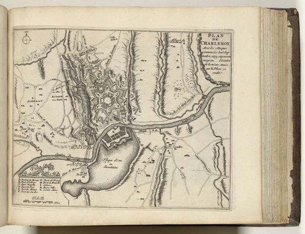
Curator: We are looking at "Plattegrond van Brussel, ca. 1693-1696," a drawing from the late 17th century held at the Rijksmuseum. Editor: My first thought is geometry—severe, precise angles that contain, almost strangle, what lies within. There is a somber feel to the overall composition. Curator: Indeed. The anonymous artist has used ink to render this baroque-era cityscape with an emphasis on military fortifications. Note the precise linework, and the repetition of forms, indicative of the rational structure prized in that era. Editor: The stark contrast between the controlled, fortified edges and the softer, more organic shapes within speaks volumes about power and control. Each bastion, each star fort, signifies not just defense, but dominance. Curator: And how those repeating star-shaped defensive structures visually echo and amplify the centralized power structure itself. Consider the relationship between negative space and positive form: the darker ink emphasizing the city’s defensive outline pushing against the emptiness around it. Editor: Symbolically, the map presents the city as a prize, something worth defending and, implicitly, controlling. It evokes the anxiety of the period – a constant state of potential siege and warfare. It makes me think about the personal lives contained within those sharp edges. What was the cost of such fortifications on the daily life within the walls? Curator: An insightful point. It highlights how this seemingly objective map subtly communicates the era’s complex socio-political tensions. This isn't just geographical representation. The ink, line, and structure create more than just a spatial map, but encode the power dynamics. Editor: Yes. The image also highlights the cultural memory, as Brussels transformed behind defensive perimeters built over centuries, in perpetual preparation to stand a seige. It makes you wonder if the need for defense ultimately came to define it. Curator: I concur. Ultimately, this drawing compels us to see beyond its functional purpose. It invites deeper questions about security, representation, and the psychological impact of the built environment. Editor: A fascinating interplay of form and the deep anxieties underlying Brussels' cityscape in a period of great political change.
Comments
No comments
Be the first to comment and join the conversation on the ultimate creative platform.
More like this