Dimensions: height 190 mm, width 190 mm
Copyright: Rijks Museum: Open Domain
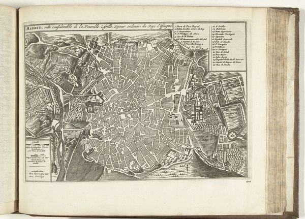
This is a map of Mechelen, created between 1775 and 1825 by an artist named Berlin. It's a detailed plan, rendered in fine lines that delineate the city's structure. The composition is striking, with the city's layout fitting almost perfectly within an oval shape. Straight lines intersect at angles, creating a network of roads and buildings that fill the interior space. The uniformity in line weight gives the city a sense of cohesion, despite the complexity of its design. One can interpret this map through a structuralist lens. The map presents the city as a system, where each element is interconnected and contributes to the overall function. The grid-like structure could be seen as a symbolic representation of power and control, a way of imposing order on the urban landscape. At the same time, the level of detail invites us to explore the many layers of meaning inscribed in urban space.
Comments
No comments
Be the first to comment and join the conversation on the ultimate creative platform.
More like this