drawing, print, ink, engraving
#
drawing
# print
#
ink
#
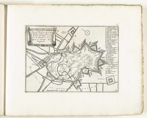
cityscape
#
islamic-art
#
engraving
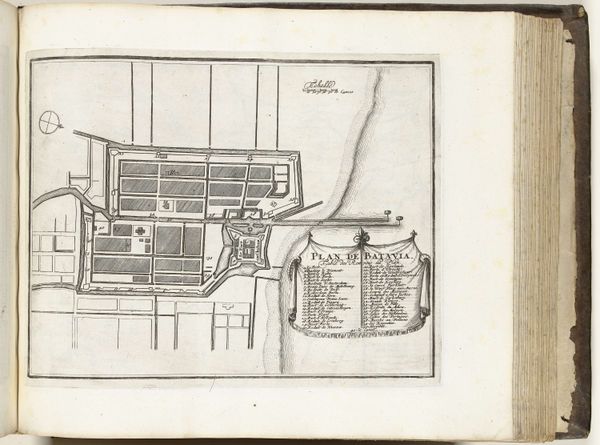
Dimensions: height 226 mm, width 296 mm
Copyright: Rijks Museum: Open Domain
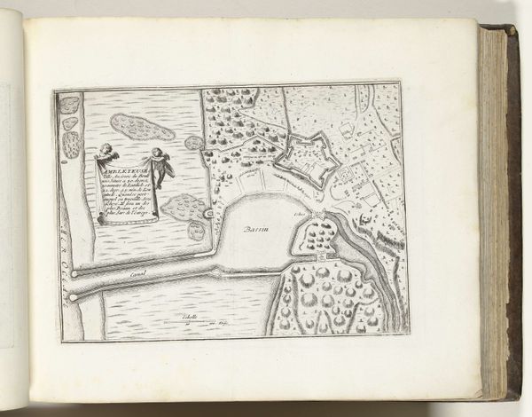
This is a map of Batavia, modern-day Jakarta, created around 1702 by an anonymous artist. The rigid grid layout, punctuated by fortifications, speaks volumes about control and order. Consider the compass rose, a symbol that transcends mere navigation. In medieval maps, it signified not just direction, but also destiny and divine guidance. Here, its presence hints at the aspirations of the Dutch East India Company – a blend of exploration, trade, and domination. The grid-like structure, reminiscent of Roman military camps, evokes a sense of imposed order. This motif echoes through history, from the planned cities of antiquity to modern urban developments. It is a testament to mankind’s desire to tame and control the environment, to create a rational space within the chaos of the world. In essence, this map is more than a geographical representation; it's a potent symbol of cultural ambition, a stage upon which human dramas of power, exploration, and settlement unfold. The city plan is a palimpsest, with echoes of other cities and other times, all resonating in this image.
Comments
No comments
Be the first to comment and join the conversation on the ultimate creative platform.
More like this