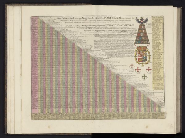
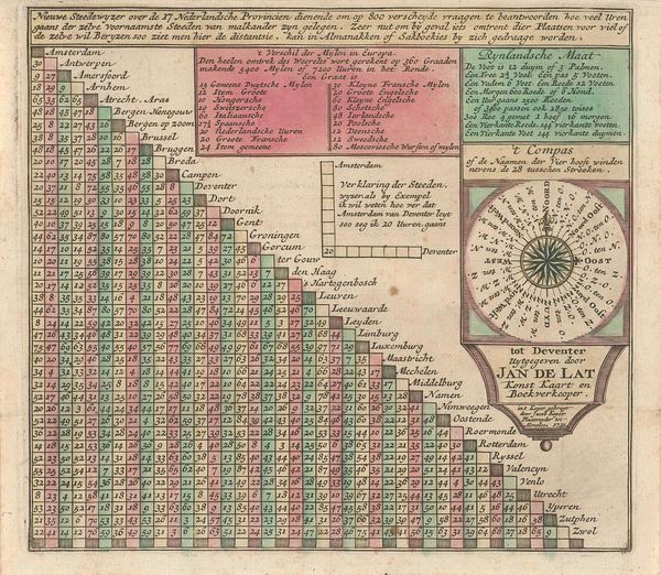
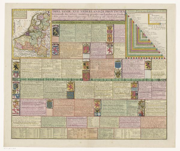
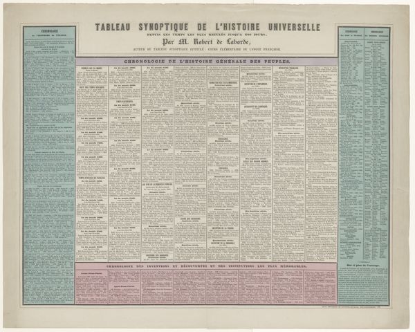
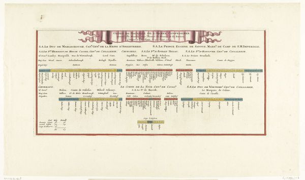
Blad met geografische informatie en een theorie over het boren van putten 1803 - 1879
0:00
0:00
graphic-art, lithograph, print
#
graphic-art
#
lithograph
# print
#
geometric
#
history-painting
#
academic-art
Dimensions: height 516 mm, height 678 mm
Copyright: Rijks Museum: Open Domain
Editor: This print, “Blad met geografische informatie en een theorie over het boren van putten” from between 1803 and 1879 by Artistide Michel Perrot, is striking in its intricate detail. The varied line weights and the methodical arrangement of text and image create a compelling structure. What can you tell me about its composition? Curator: Indeed. Observe the artist’s strategic use of line and color to differentiate layers of geological strata. Consider the impact of the grid-like arrangement – how does it affect your perception of the work? The precise draftsmanship and chromatic variations serve primarily to articulate geological principles rather than aesthetic pleasure. Editor: It seems very calculated, more informative than expressive. Is that intentional? Curator: Precisely. Note the visual hierarchy established through size and placement. The geological cross-sections and diagrams function as signifiers within a visual language aimed at explicating the theory of well-drilling. The lithographic medium lends itself well to this style of detailed, reproducible imagery. The artist seems less interested in conveying emotion than in providing clarity. Do you agree? Editor: Yes, the focus is definitely on clarity and systematization. Seeing it that way makes the composition feel even more intentional and almost scientific in its approach. Curator: It showcases the intersection of art and science in the 19th century. What a useful experience it has been looking through the formal composition! Editor: Absolutely. Analyzing its formal properties truly brought forth the intent behind this detailed print.
Comments
No comments
Be the first to comment and join the conversation on the ultimate creative platform.
More like this